The Routeburn Track is one of New Zealand’s so-called Great Walks, those iconic, magical, and famously beautiful hikes the country is known for. It stretches across 32 kilometers of varied, stunning terrain, climbs nearly 1,500 meters up (and the same back down), and normally takes about three days to complete on foot. It’s a kind of shortcut for hikers, connecting the Glenorchy region (where Isengard from Lord of the Rings was filmed) to The Divide Shelter, a trailhead on the Queenstown–Milford Sound road, a drive that takes roughly 4.5 hours. Three days, 1,500 vertical meters up and down, and 4.5 hours by car.
For mere mortals, that is. So naturally, my brother-in-law and myself set out to hike it in under 8 hours.
Huh?! New Zealand?!
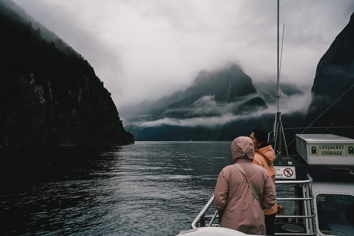
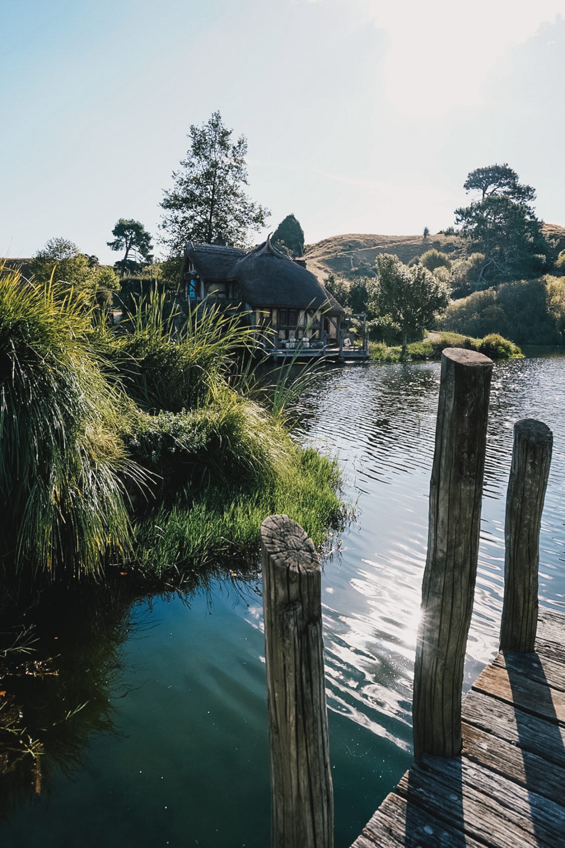
Our Routeburn-in-a-day adventure was part of a three-week adventure with my in-laws. A magical trip across the key highlights of New Zealand’s Southern and Northern Island, including Milford Sound, Queenstown, Arthur’s Pass, Auckland (with a visit to some old friends and the amazing people at IceBreaker HQ), Wellington, Hobbiton, Bay of Plenty, Coromandel … and of course, no trip without a hiking adventure.
Our Routeburn-in-a-day adventure.
06:30: Alarm.
07:15: Last-minute supplies from the supermarket.
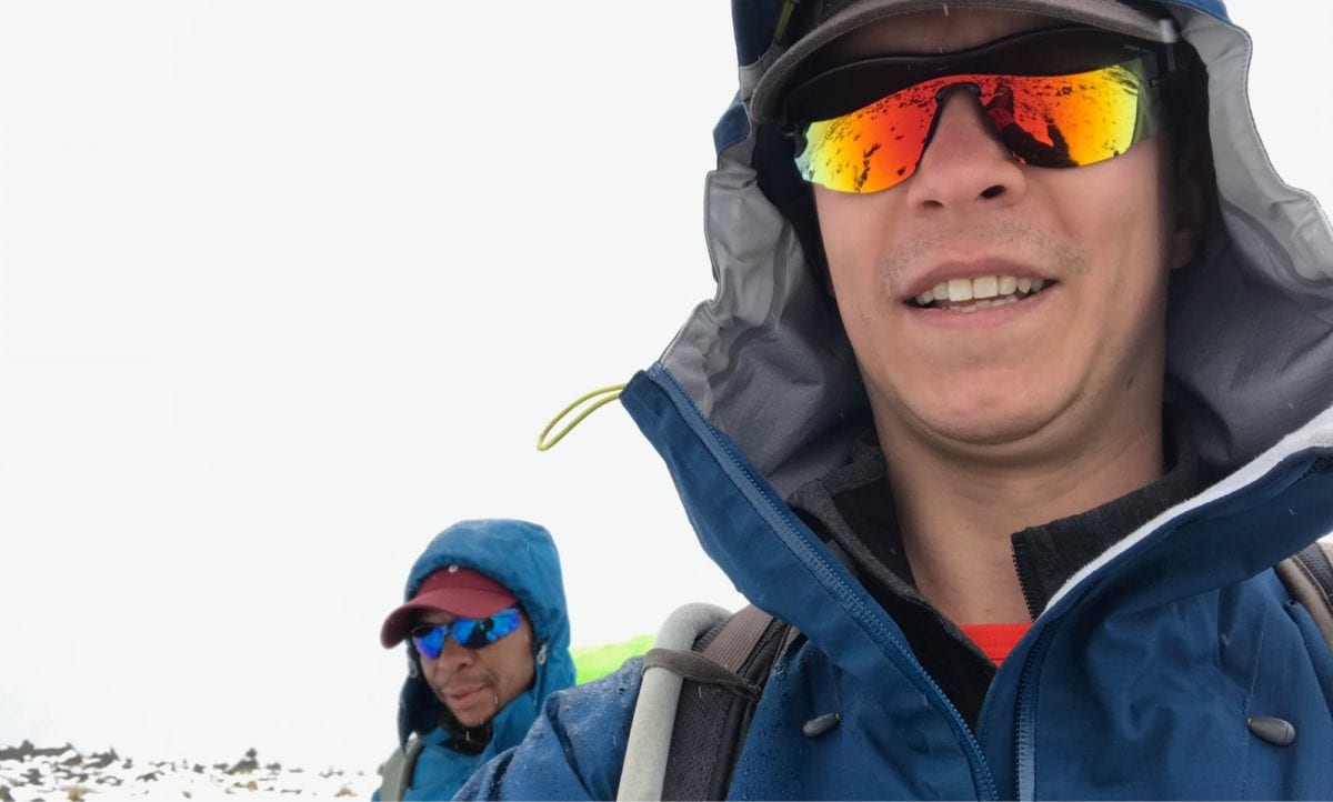
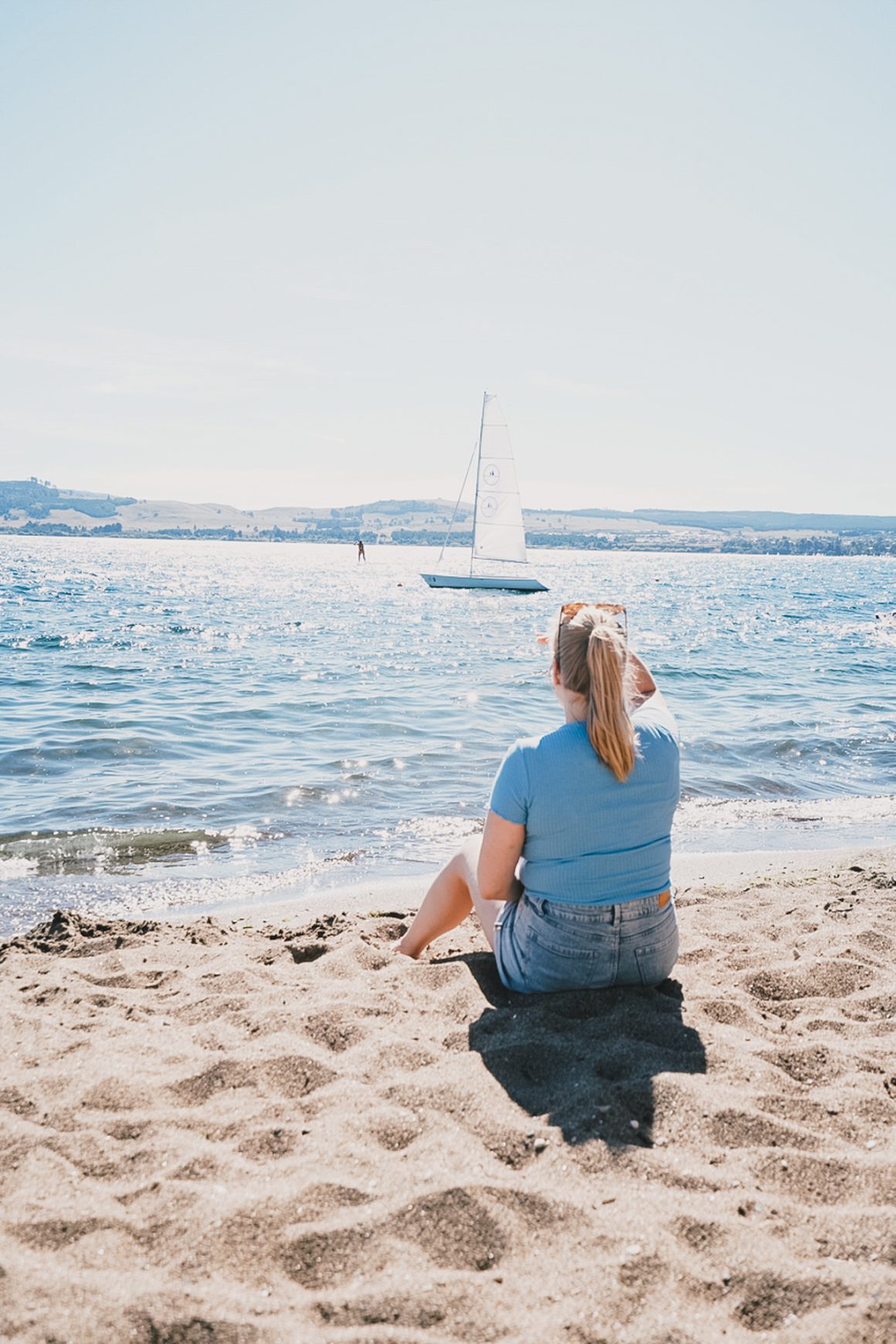
07:30: Meeting point for the transfer up to the start of the trail, near Glenorchy. Together with twenty or so fellow hikers, all buzzing with a healthy mix of nerves and excitement. The crowd? A good blend. Some couples in matching outfits trying to save their relationship and bring some “adventure” to their New Zealand trip. A cluster of Japanese hikers in trademark fluorescent gear, clearly here to conquer the trail. A couple of thru-hikers tackling the entire length of New Zealand on the Te Araroa (TA, for the insiders), a journey of months, inspired by the legendary Belgian ultra runner Karel Sabbe, who recently ran the whole thing, averaging 100 km a day. And then there’s us.
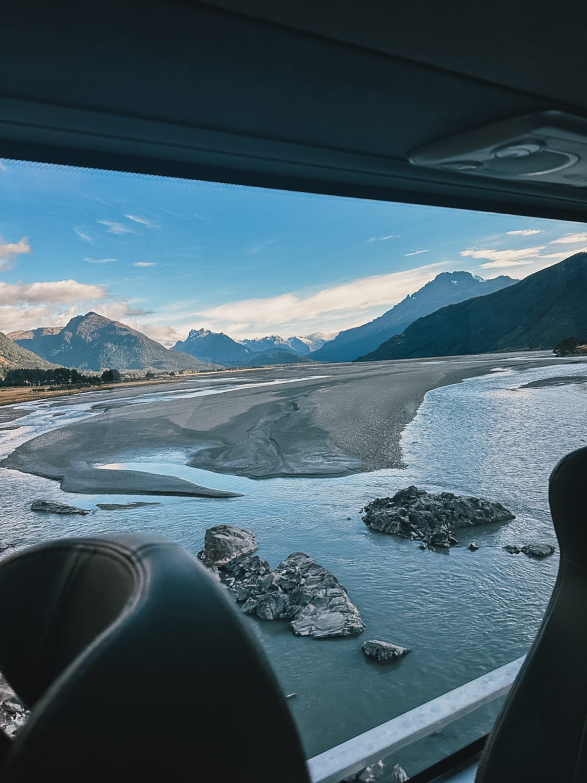
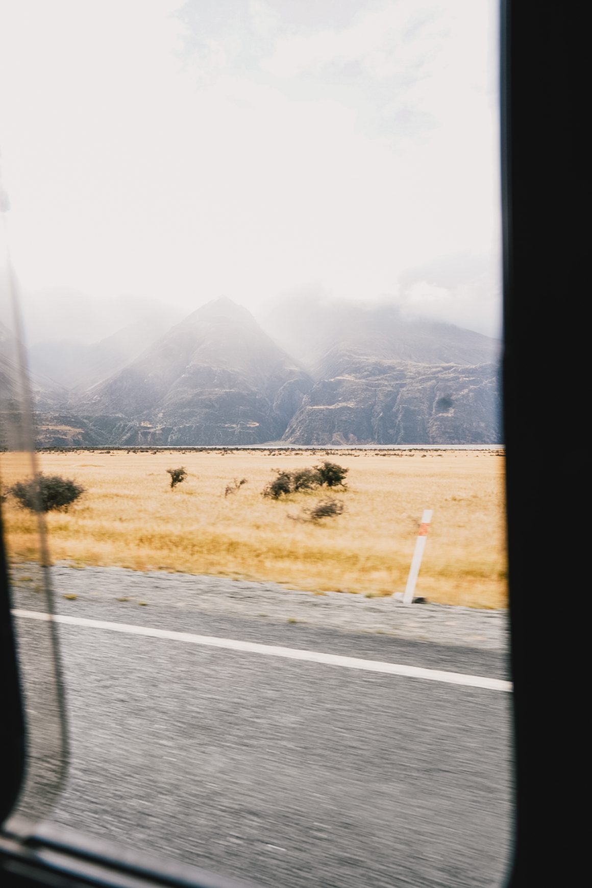
The 75-minute bus ride is never dull. Every minute, the landscape becomes more dramatic. Mirror-like lakes, the timeless idyll of Glenorchy, and finally the filming grounds of Isengard. Then, abruptly, we stop. We’re here. Everyone out. A squat concrete structure—brutalist crematorium vibes—serves as the trailhead. Final gear check. Water bottles filled. Snacks within reach. And then we’re off.
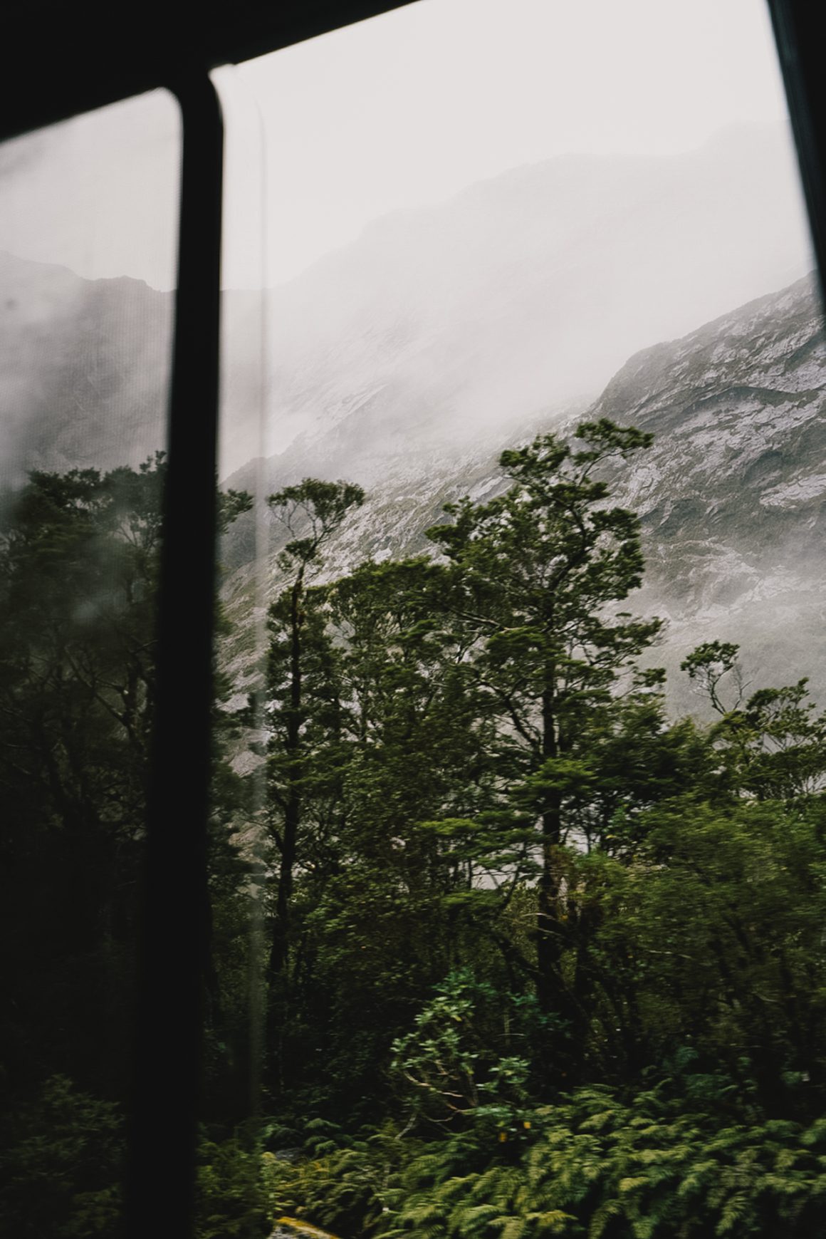
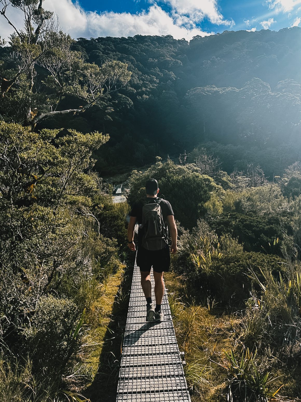
The first 2.5 hours are a gentle warm-up. Wide, well-kept trail, allowing us to walk side by side through subtropical forest. Pace: a comfortable 5 to 6.5 km/h. Sunshine. Limbs loosening. It’s the perfect beginning. Because after that … the climb begins.
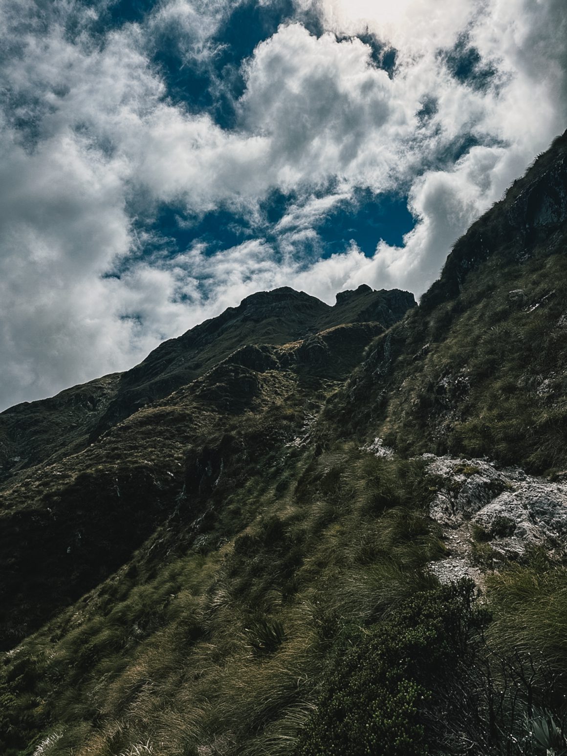
The ascent to Harris Saddle, the highest point of the hike, is a milestone. Not just because it feels like the hard part is over, but because it’s the logical spot to update our support crew. Ideally, the hikers on foot and the campervans meet at the Divide parking lot around the same time. From the saddle, it’s mostly downhill, so it’s the right moment to make a time estimate.
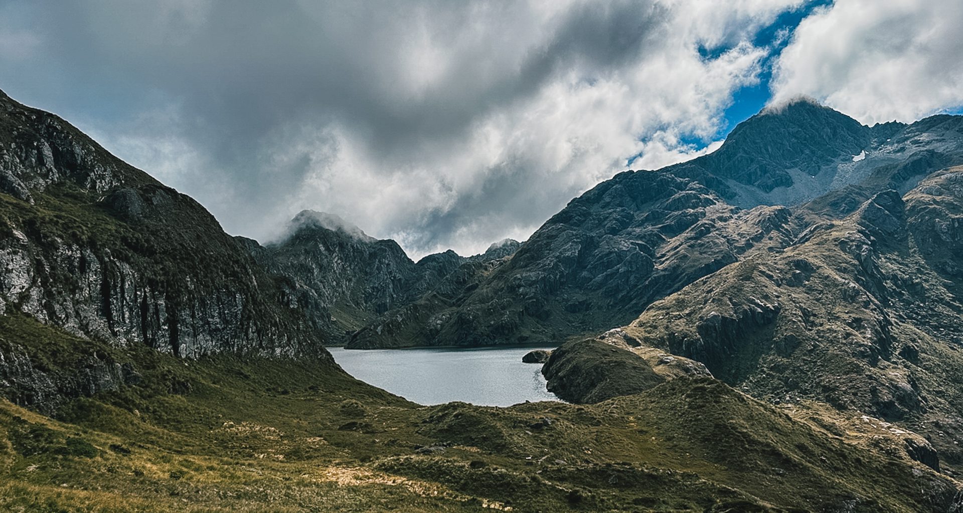
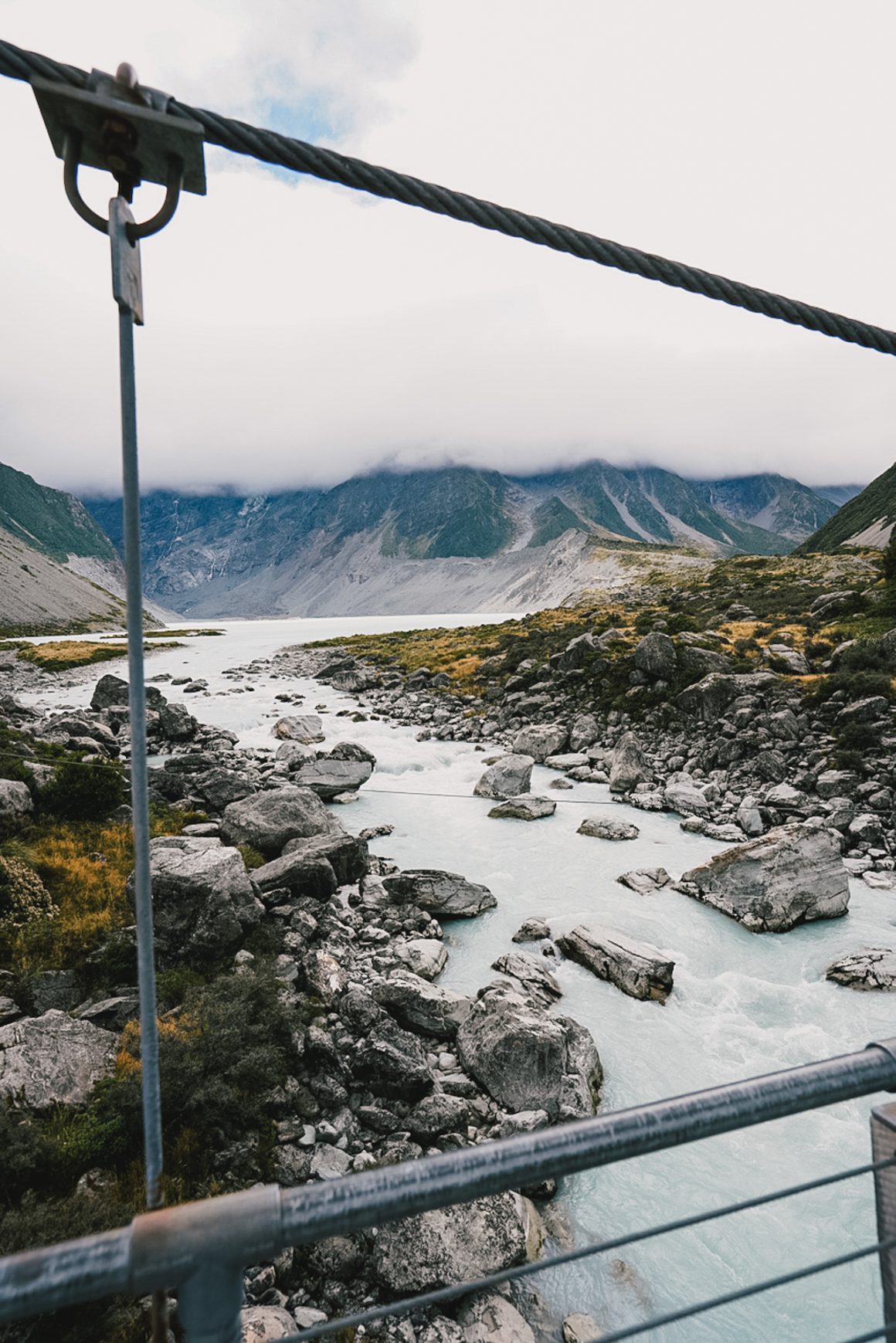
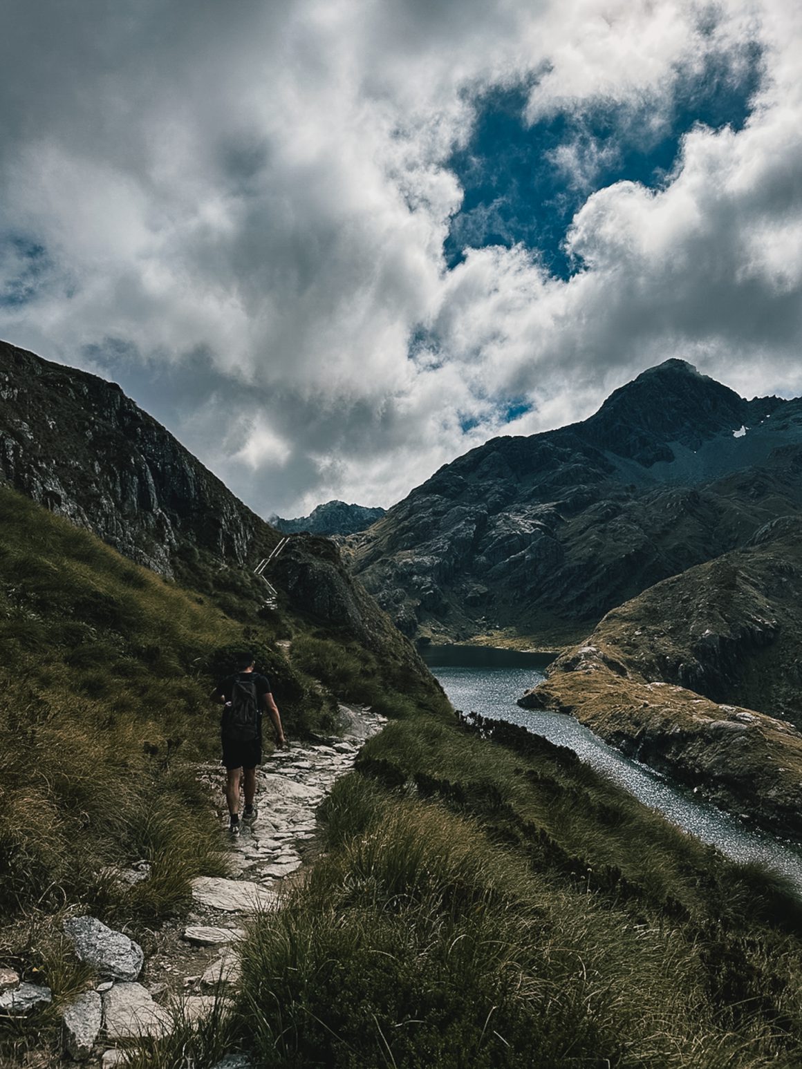
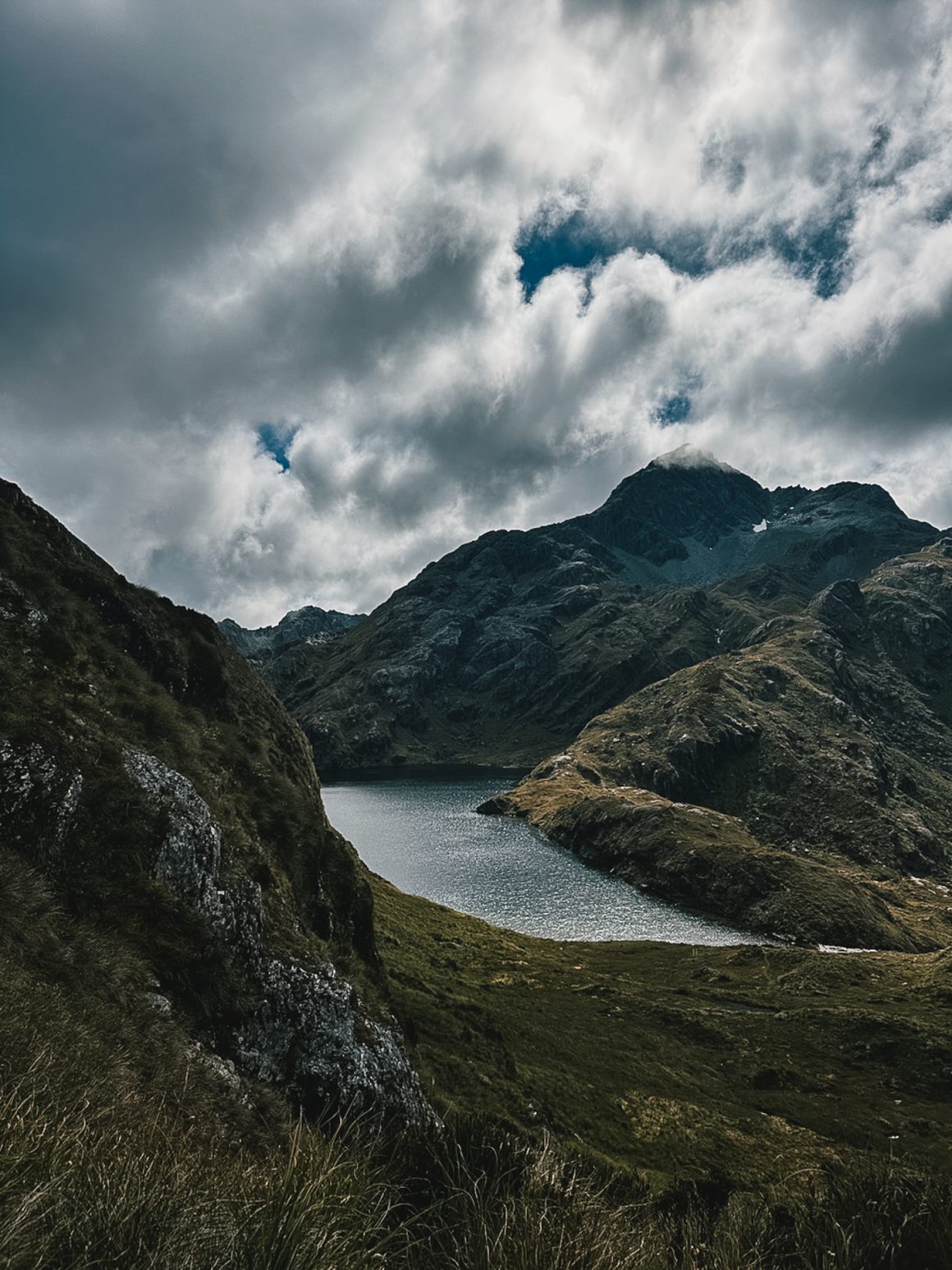
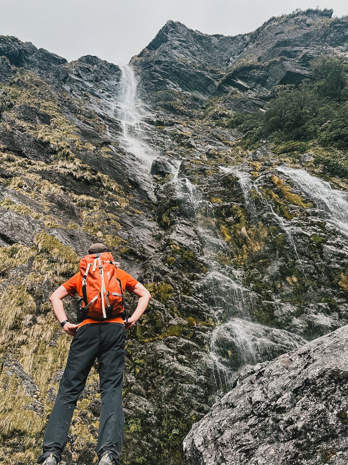
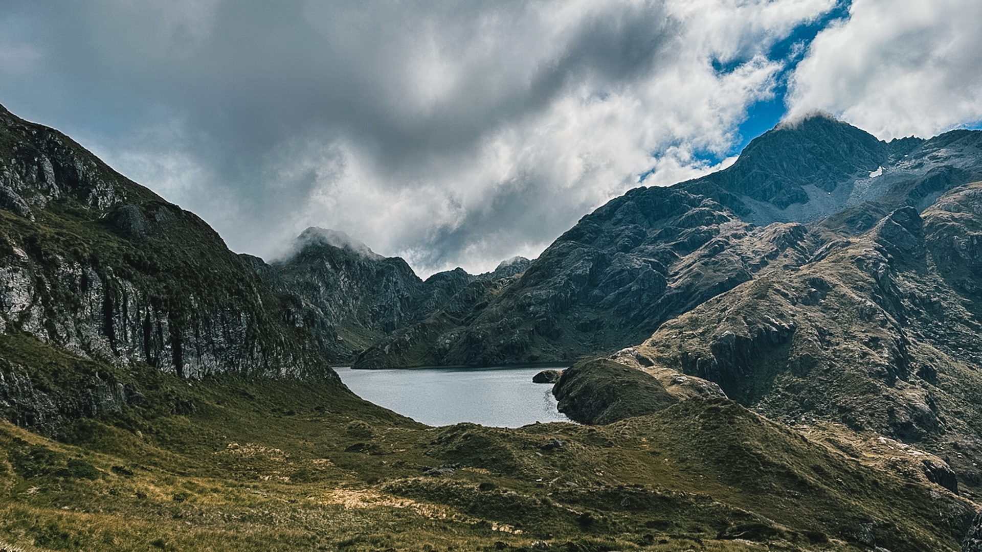
And so it begins. One of us sets the pace. The other (me), tethered like a tired sled dog, struggles to keep up. The scenery? Unreal. A never-ending string of waterfalls and ever-better views, each corner more breathtaking than the last. A mountain lake just before Harris Saddle steals the show … straight out of a Lord of the Rings scene.
Beyond the views and the blossoming bromance, the fellow hikers are a highlight too. The Routeburn crowd leans a little “Outdoor Trade Show chic”; well-equipped couples, solo wanderers, and lots of guided tour groups with name tags (!). Trail etiquette quickly becomes clear: always greet, always smile, often chat. One of us keeps it modest, just a polite “hey” or “hi.” The other (me)? Full-volume ENJOOOOOOOY with every passerby, trying to inspire some trail cheer … from time to time, it feels like a remote Nijmegen Four-days-march.
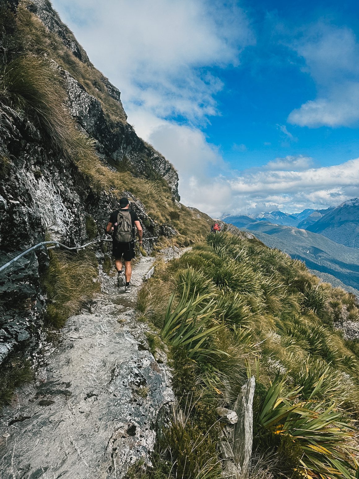
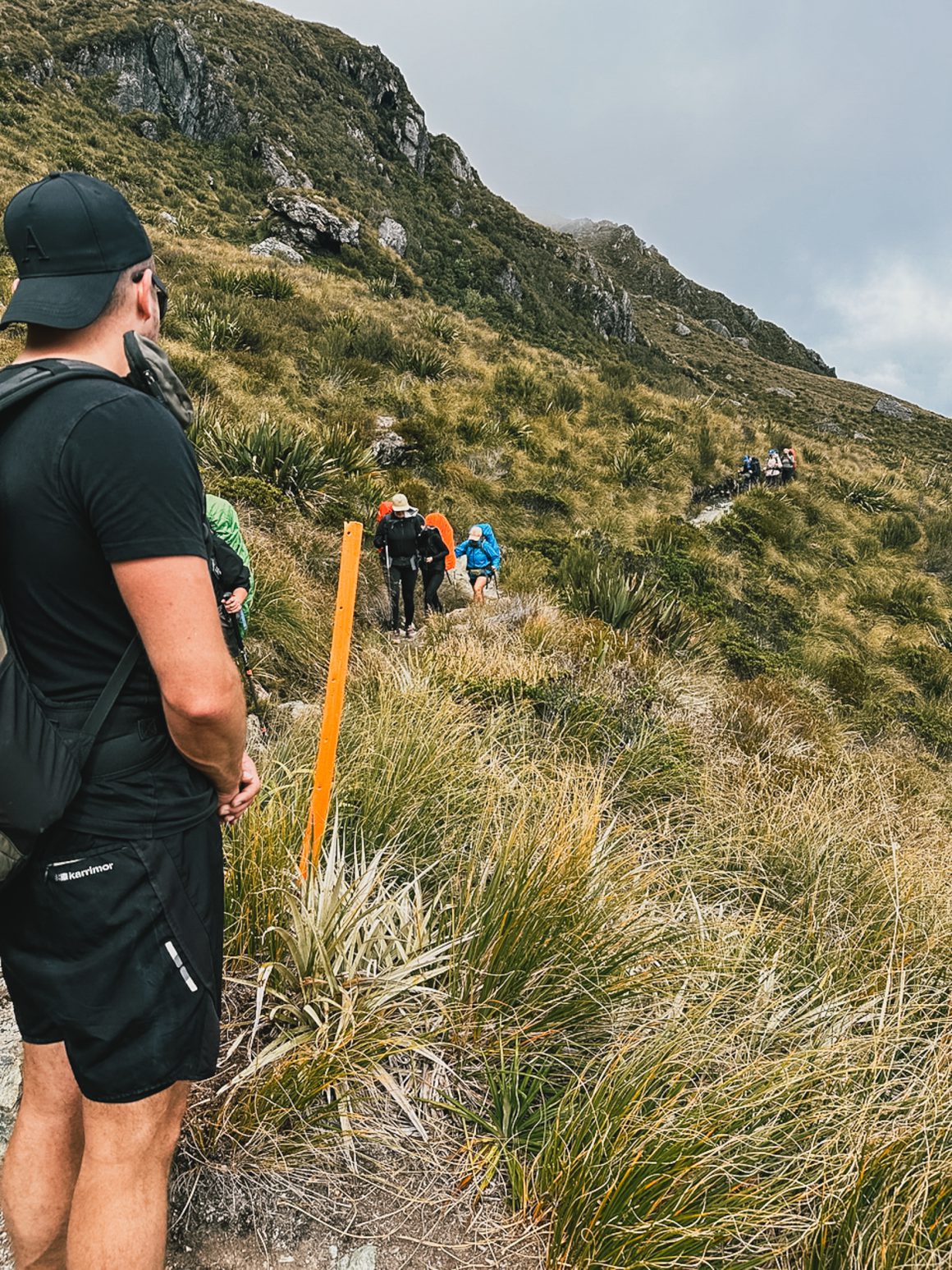
We pass families, American women who already got lost once, chatty guides, and hikers equipped as if surviving in the wild for a month. And then … Harris Saddle. Glorious. Majestic. And the perfect place for a toilet break. One catch: no cell signal. At all. Not there, not anywhere on the trail. Great for connecting with nature. Not so great for updating the folks back home. A satellite message is sent, but with the chaos of different SIM cards, even that feels futile. So we go with the flow and push on.
The next stretch? Bit of a letdown. A long, flat ridgeline with less-than-ideal footing. The pace slows. Morale dips. Spirits are kept up with bursts of ENJOOOOOYs and a steady supply of milk chocolate and wine gums.
A steep descent follows, then the final leg through ancient tropical forests—again, stunning. And then: the grand finale. A 174-meter waterfall that steals the show. Only one thing could ruin it: a bottle of Tiroler Kola, my brother-in-law’s new unofficial sponsor. Undrinkable. But hey, brand deals are brand deals. So after a photo op featuring the Kola and our trail-weary selves, it’s time for the final sprint.
The pace? Somewhere between turbo-charged mobility scooter and Olympic race walk. Roughly 6.5–7 km/h. We push through.
And then, after 7.5 hours, we make it. 32 kilometers, 1,500 vertical meters, a bag of wine gums, and a bar of chocolate later—we hit the parking lot. Phone reception returns. Only to hear the support crew didn’t believe we’d pull it off, and it’s still an hour away.
So, naturally, we do what any two slightly feral men would do: we start walking toward them.
Another 6 km along the road, bringing the total to just under 38 km for the day. The reward? Hugs. A dip in the river. And the best burgers we’ve ever eaten.
Reflecting on the Routeburn Track.
I find it hard to reflect on the Routeburn Track. I think I’m spoiled … a lingering feeling throughout my New Zealand trip … Sure. It’s really really amazingly beautiful, but it isn’t something I haven’t seen before. Maybe my expectations were off. Sure, Milford Sound was stunning. But was it that much more beautiful than the Faroe Islands, Iceland, or other more remote parts of Scandinavia? Or maybe Patagonia? Sure, Bay of Plenty was amazing … but was the beach that much better than a nice Greek beach? Same for the Routeburn Track. Sure, it was really really nice, but was it nicer than Laugavegur trail (which I still feel maybe all-round is the most beautiful track I’ve ever done)? Or as overwhelming as the vastness of the Faroe Islands, the Jordan Desert or the Drakensberg escarpment? Sure, it is a great trail, but maybe not worth the hype.
So, absolutely, if you have the chance, please do hike the Routeburn Track. You won’t regret it for a moment. But set your expectations right, I’m not sure it is one of the absolute most beautiful hikes in the world.
Making it a bit more concrete and tangible:
The trail itself is very well-marked (although we did encounter a group of women that got lost on top of a climb … how still beats me), and through the thousands and thousands of hikers before you, the trail is easily accessible. Especially for more experienced hikers, it is a fast lane to the finish.
The challenge. It isn’t a challenge to be taken lightly. 1500 meters up is no joke. But especially when the hike is broken up into the recommended 3 days … it is totally doable. With some proper preparation, exercise, and experience, a one-day hike is totally doable. Key challenges in this case are logistics … you need to find a way to get dropped off at the starting point and also be picked up at the end (as the transfer/shuttle times back and forth to Queenstown are impossible to combine) … and the weather (weather may change suddenly, so this is definitely something to take into account).
The fellow hikers. This all leads to a wide variety of hikers. Because the trail is so well-known, so popular, and so hyped-up, expect a lot of inexperienced hikers; people with little trail etiquette, people struggling because they didn’t properly prepare, … guess all the reasons why Peaks of the Balkan made me realise again that I need more remote trails in my life.