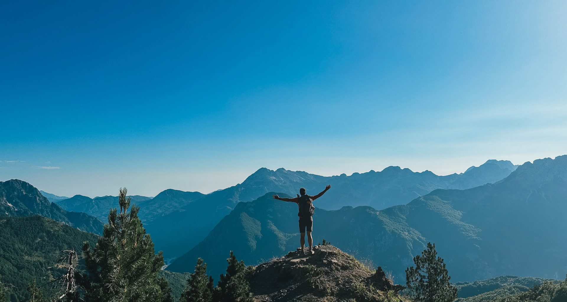
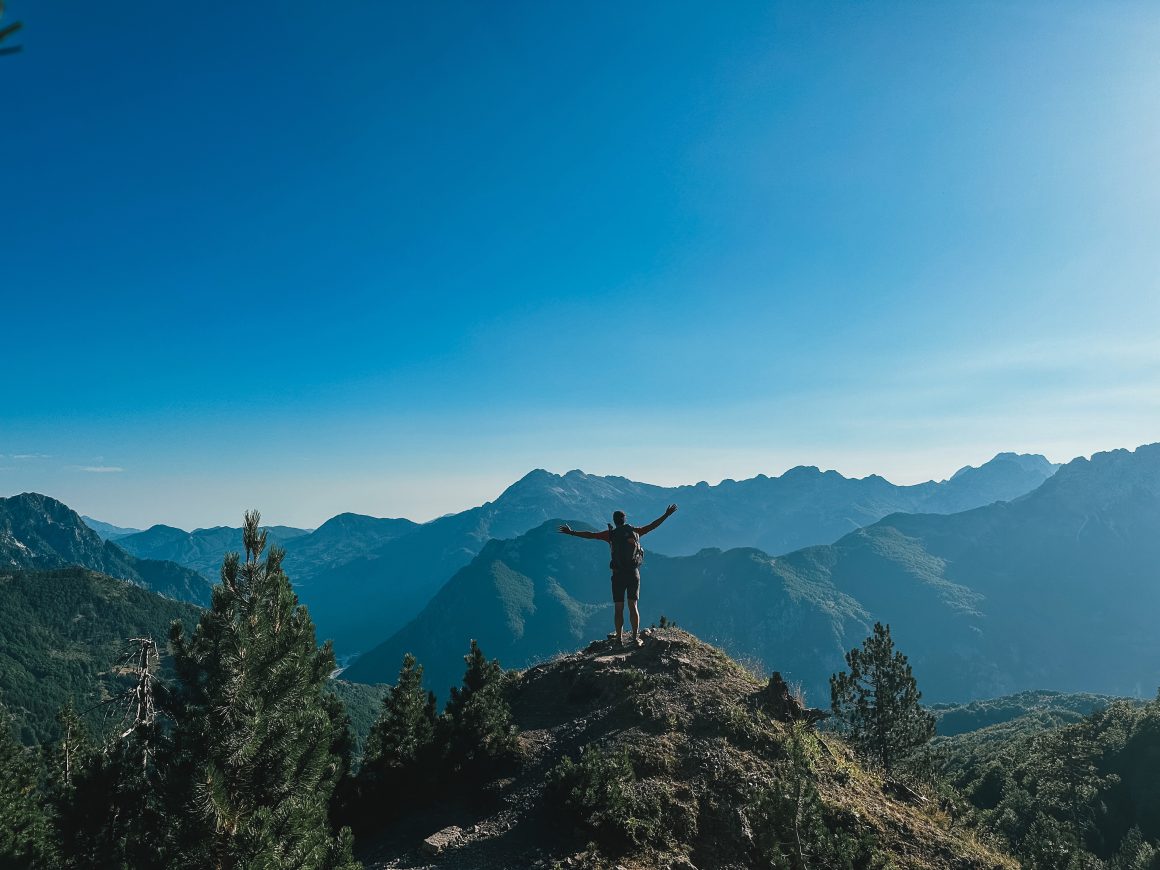
“Europe’s last true wilderness”, as BBC called it in an article. The Peaks of the Balkans trail in the mountainous region bordering Montenegro, Albania, and Kosovo. I hiked the 192 kilometers in 6 days in 2023. I loved it, hated it, made a range of stupid mistakes, broke a trekking pole and air mattress, formed a conga line with Dutchies, got drunk with a group of friends from Croatia, clocked 42 kilometers in one day. This is my story of solo hiking Peaks of the Balkans through Albania, Kosovo, and Montenegro.
This is an overview of my experience solo hiking Peaks of the Balkans. Please see separate posts on planning for my Peaks of the Balkans trip and my packlist for Peaks of the Balkans.
Table of Contents
- Before: Homesickness for the trail
- Before: A quick introduction to the Peaks of the Balkans
- Day 0: Getting there
- Day 0: Sh*t, I’ve really completely utterly lost it
- Day 1: A day of firsts
- Day 2: Settling into the trail
- Day 3: Cold awakening
- Day 4: The marathon day
- Day 5: Recovering on an unforgiving trail
- Day 6: Change of plans to avoid bad weather
- A final reflection. The stairs-ficiation of the Peaks of the Balkans
- What I learned from a week on the Peaks of the Balkans trail
Before: Homesickness for the trail
If there is such a thing as homesickness for the trail, I caught it. After my solo hike of the Arctic Circle Trail in 2020 and (failed) second attempt to finish the Jordan Trail in 2021, I had eyed to do the Peaks of the Balkans trail in 2022.
However, life is what happens to you while you’re busy making other plans – I sold a house, bought a house, moved countries, so my plans fell through and in the end I did not do a proper hike for over a year.
Sure, I did some day trips on Faroe Islands, but more and more I started to notice I missed the trail; the feeling of your first footsteps on a new trail, not being able to think about and merely focussing on where you’re going, being excited about what dried food you’re eating that night and what amazing view you will wake up to the next morning. So, I was and am just beyond excited to be finally back on the trail again.
Before: A quick introduction to the Peaks of the Balkans
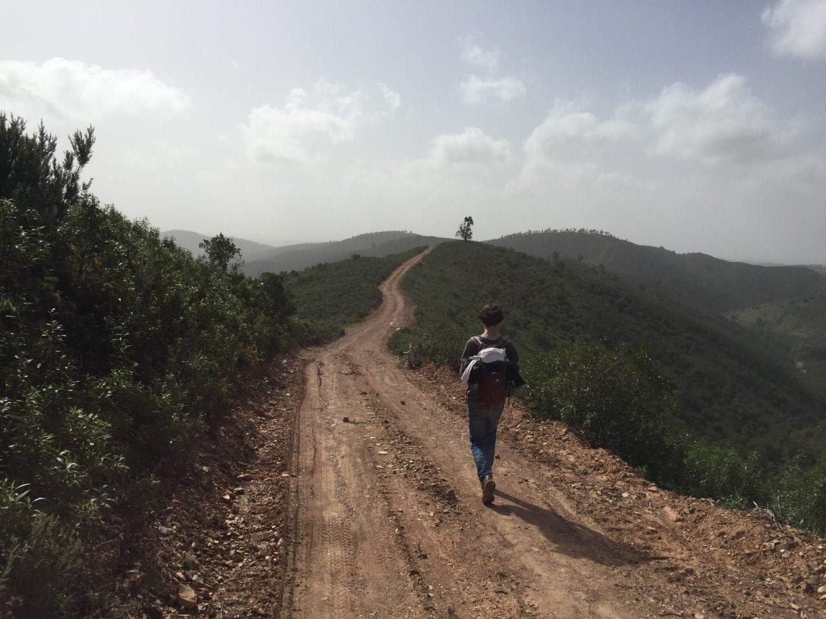
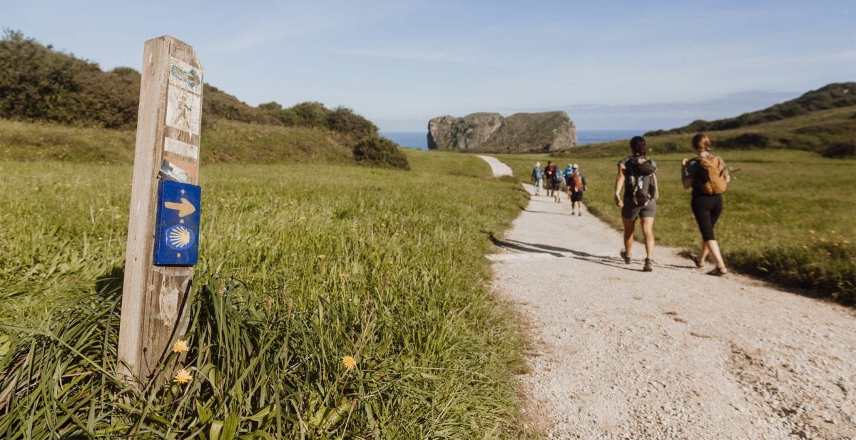
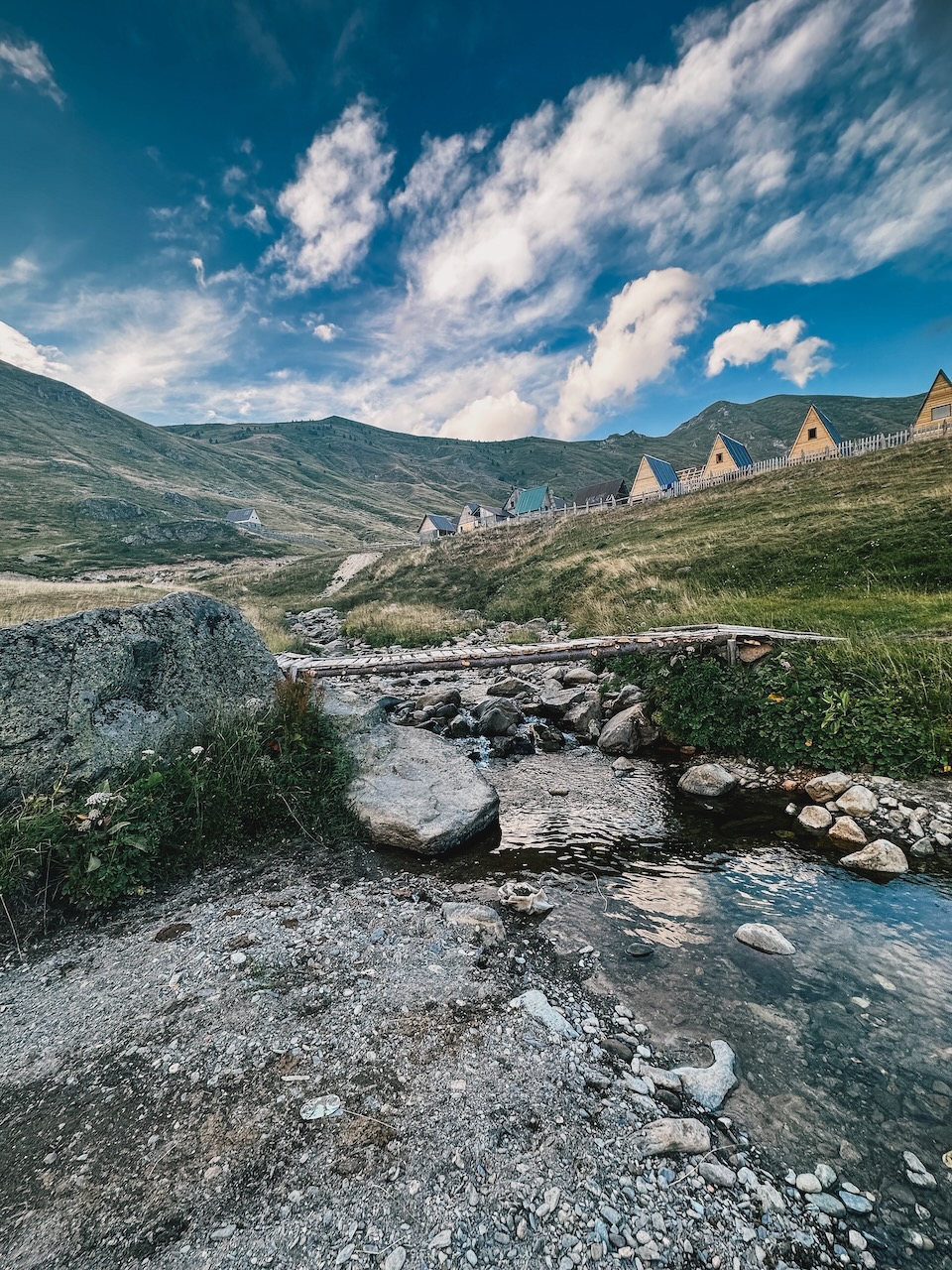
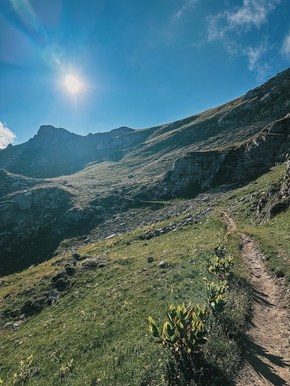
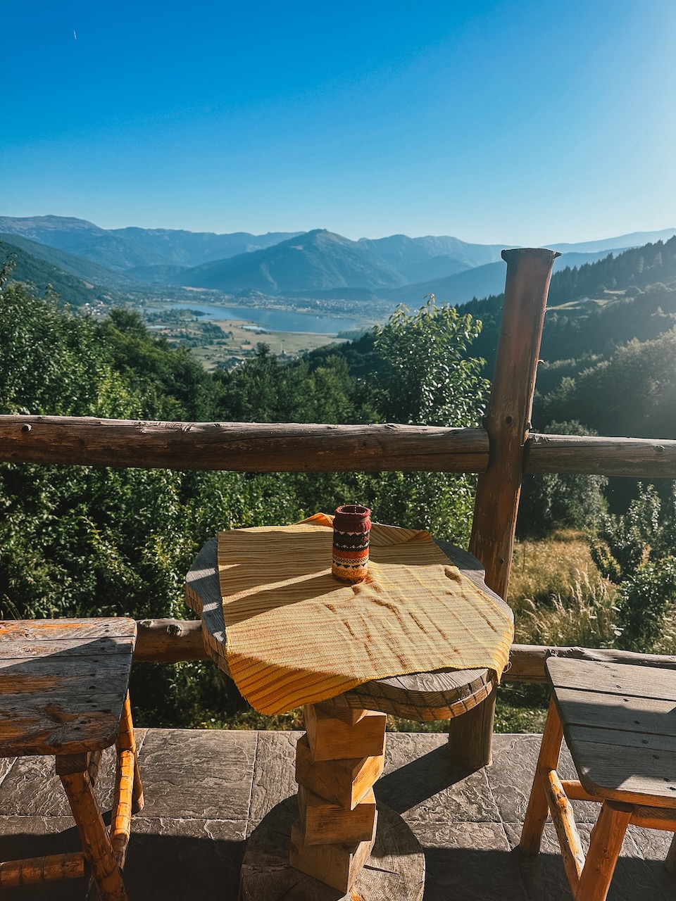
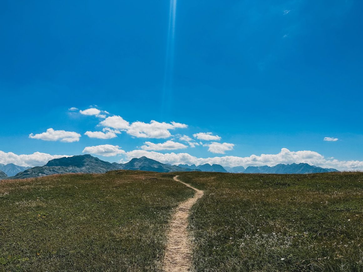
Stretching 192 kilometers, the Peaks of the Balkans Trail bridges three nations, Albania, Kosovo, and Montenegro, and crosses through some of the continent’s least-explored landscapes. Hiking through the green valleys and wildflower-strewn meadows, one can feel the utter remoteness of this captivating landscape, where the gunmetal-grey Albanian Alps, locally known as Bjeshkët e Nëmuna or Prokletije, tower overhead. Unlike Europe’s more famous alpine resorts, this region lacks hotels or ski lifts, adding to the sense of isolation and the feeling of stepping into a hidden world that has eluded the attention of the outside world.
The origin of the name “The Accursed Mountains” remains a mystery, with local legends offering intriguing tales. One story suggests that the devil himself sculpted the jagged glacial karsts in a single day of mischief, while another recounts the curse of a woman who, trekking with her children on a scorching-hot day, couldn’t find any water and cursed the mountains in frustration. Some claim that Slavic soldiers struggling to march through the peaks named them as such. In a way, the enigmatic origin story of the mountains mirrors the enigmatic nature of Albania as a whole, a land with a complex and layered history waiting to be discovered.
Embarking on the Peaks of the Balkans adventure allows hikers to explore these stunning landscapes while experiencing the cultural tapestry of the region. The trail not only presents a physical challenge with its rugged terrains but also offers an opportunity for visitors to engage with the local communities and witness their resilience and hospitality This transnational trail not only showcases the natural beauty of the Balkans but also serves as a symbol of unity and cooperation, connecting nations through a shared love for their extraordinary landscapes and a desire to share them with the world.
Day 0: Getting there
Day 0: Tirana to Valbone via Koman and Fierze.
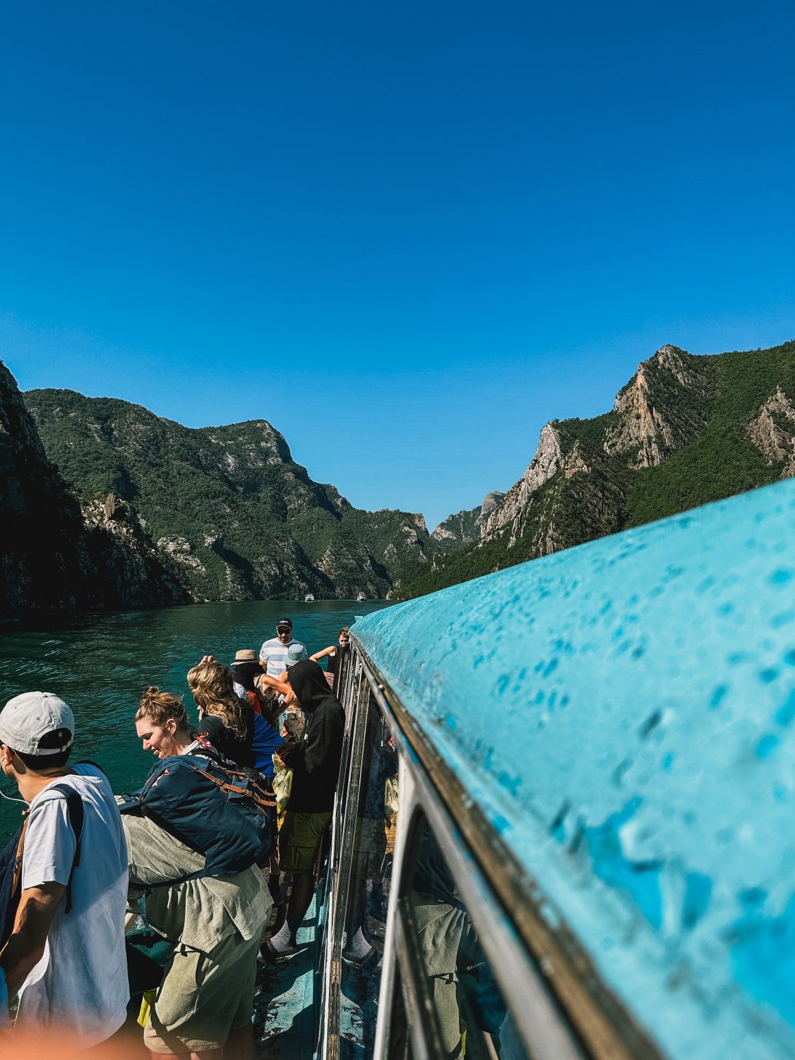
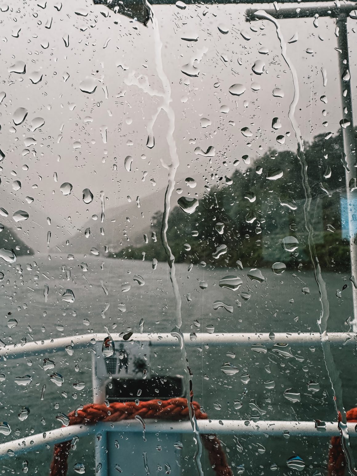
I found myself staring with my mouth wide open. I had seen some pictures, but nothing could prepare me for what I was seeing. I was standing on an old, rusty ferry that transported me and many other tourists from Koman to Fierze over Komani Lake, which was breathtakingly beautiful.
I had opted for a detour to get from my home in Belgium to the trail. Most people started from Theth or Plav, but because I wanted to fly with my favorite airline loyalty program and had seen pictures of Komani Lake, I decided to fly to Tirana, take a 3-hour bus from Tirana to Koman, take the 2.5-hour ferry from Koman to Fierze, and finally take a 1-hour bus from Fierze to Valbone. It was a longer trip than necessary, and my flight had been delayed, the taxi to my hotel was 45 minutes late, and I had only had 2 hours of sleep after waking up at 4:30am. But it was worth it.
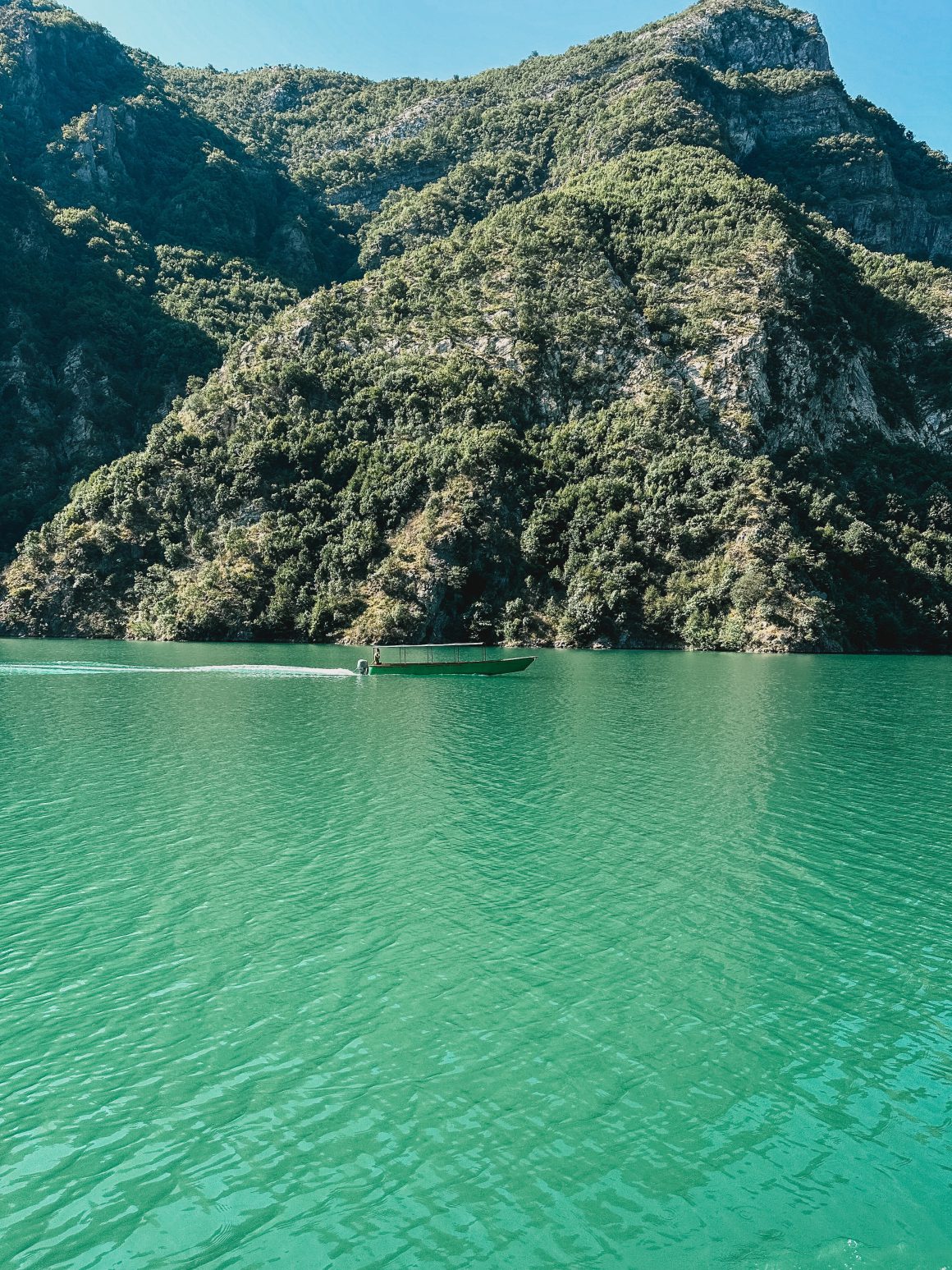
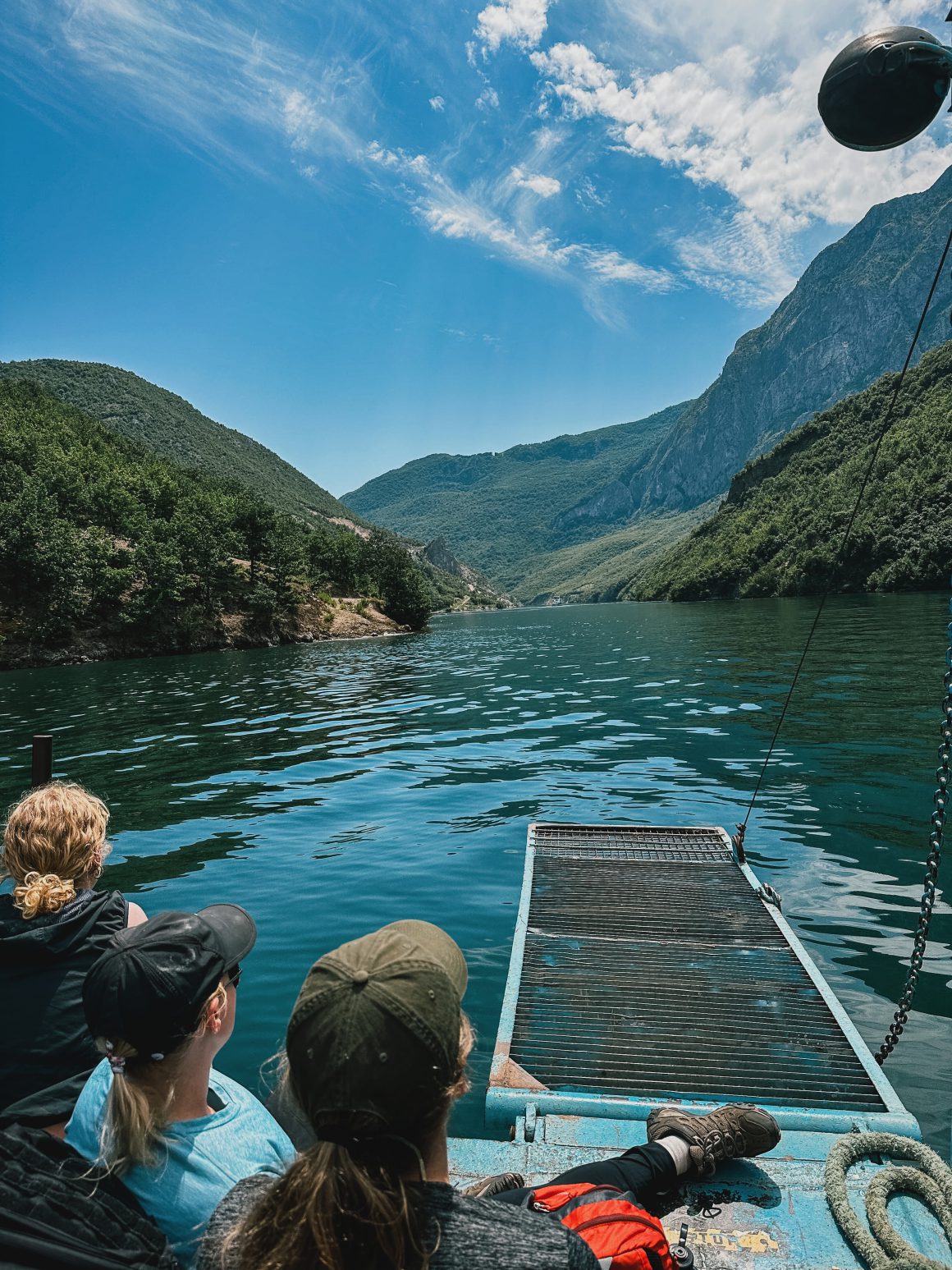
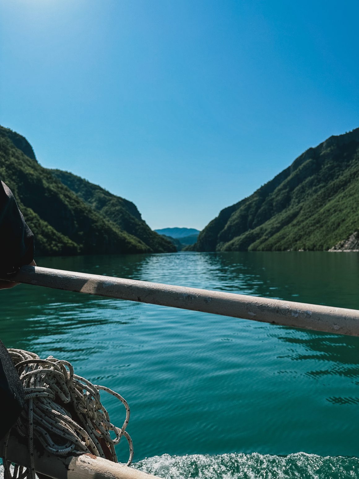
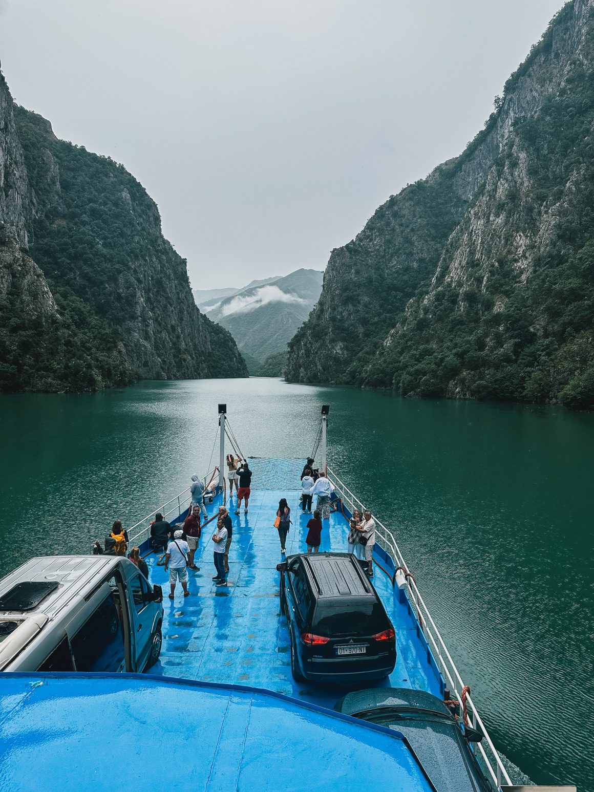
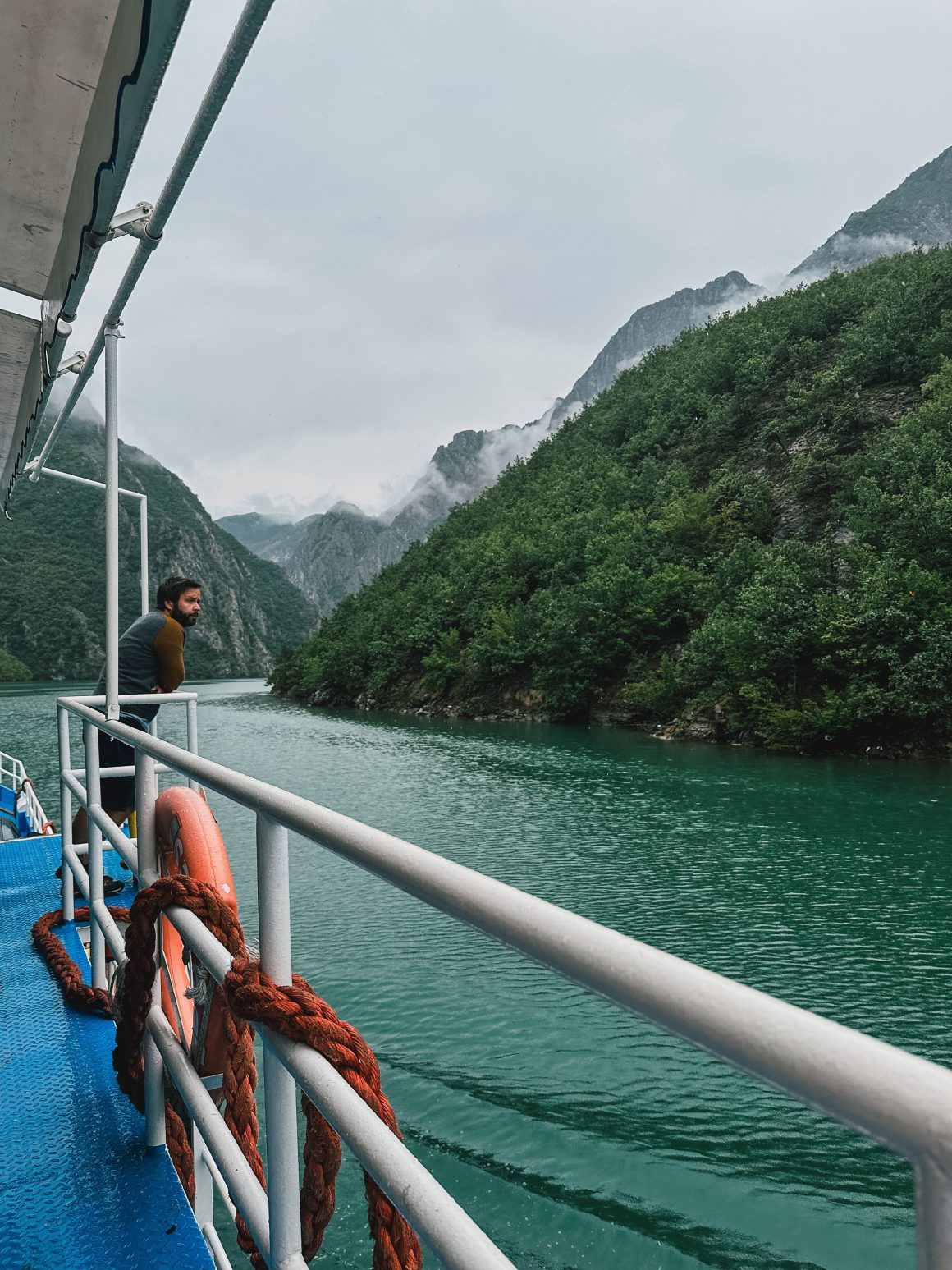
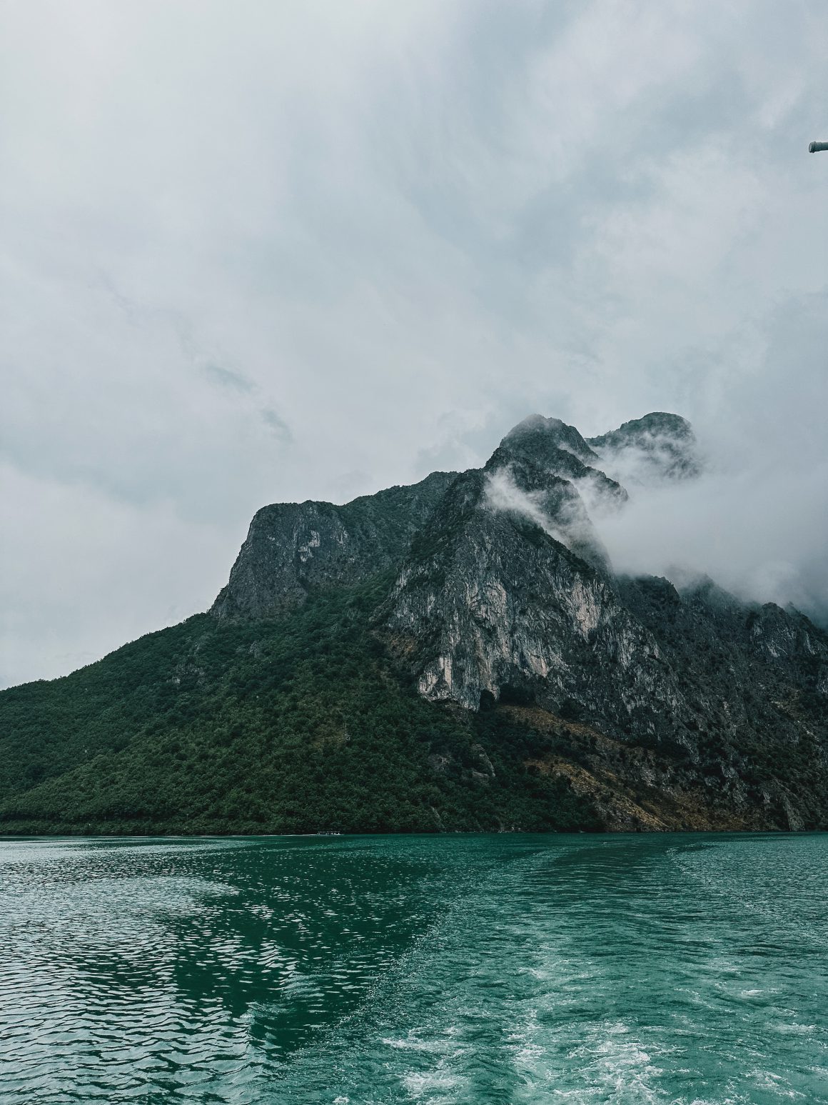
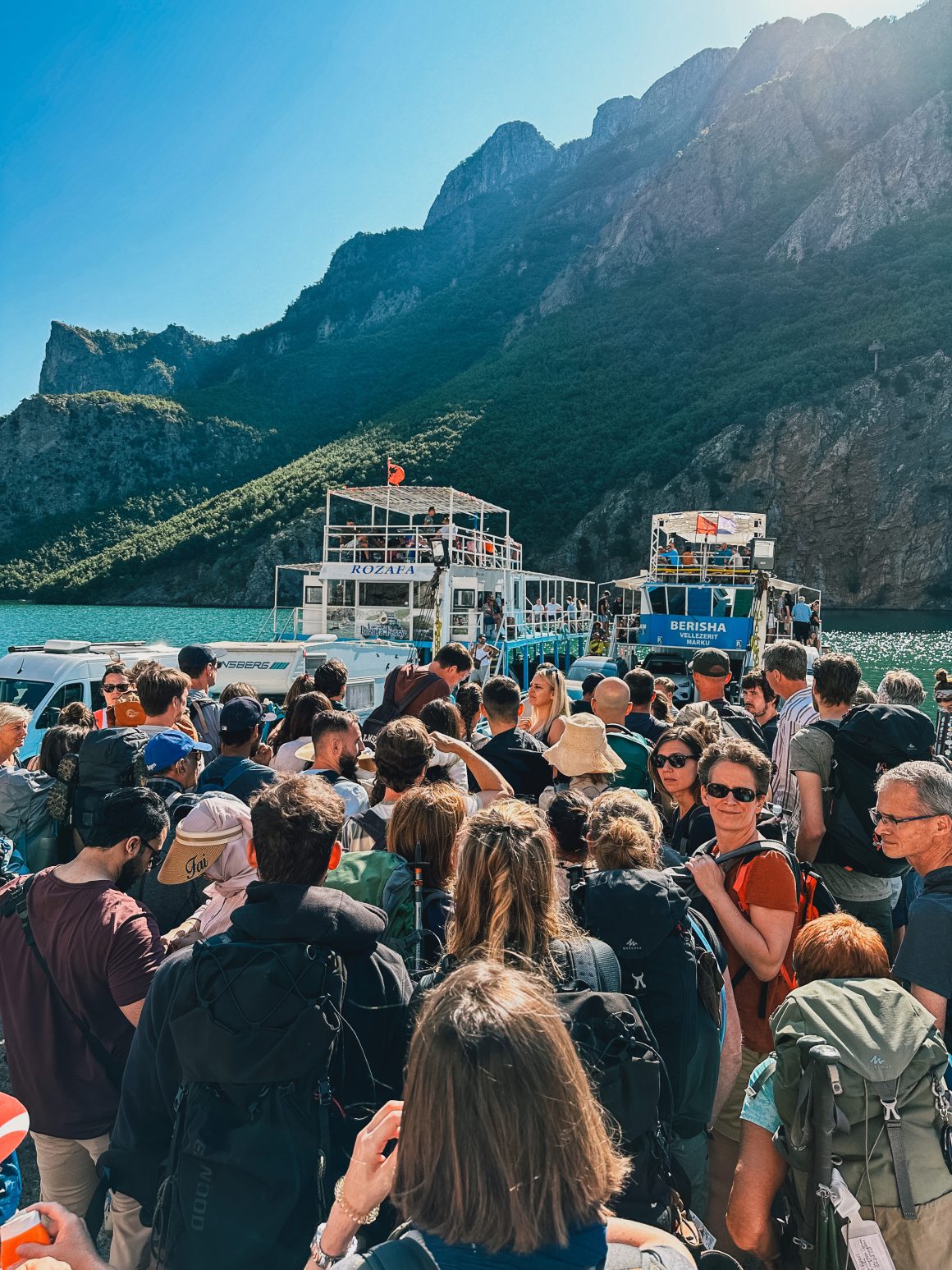
The ferry slowly made its way through a fjord-like landscape that reminded me of both Thailand and the beautiful Nordic fjords. Majestic nature surrounded us, with amazing cliffs and beautiful woods. From time to time, smaller speed boats would pass our ferry, like the ones you would see on rivers in Asia. And here and there, a house or small settlement on the mountainsides or next to the water was the only proof that people actually lived there.
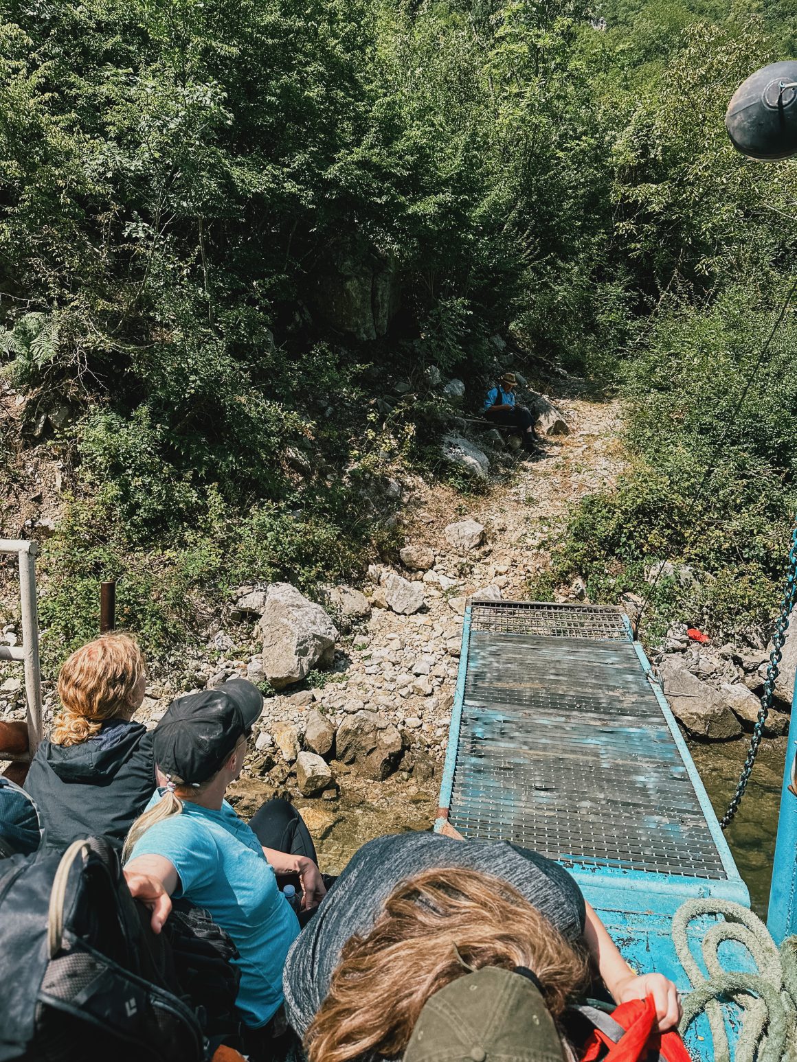
The ferry turned out to be the lifeline of the region. Locals would hop on and off regularly with suitcases, food, or building materials. We witnessed family reunions, young adults leaving their childhood homes for bigger cities, villages being restocked, and tourists hopping off for a day of water entertainment in kayaks. It was a truly magical place.
Finally, after two flights, two buses, and a ferry ride, I arrived in Valbone. After a quick lunch, I was ready to start my own adventure: a week on the Peaks of the Balkans trail.
Day 0: Sh*t, I’ve really completely utterly lost it
Stage 0: Valbone – Prosllopit pass (8.2 km, 1000 elevation gain, 3 hours)
And so much for all the positive vibes. After all these years, I’ve collected my fair share of hiking experience, but today, I just made all the rookie mistakes a person can make.
It’s not even 15 minutes into my Peaks of the Balkans adventure, and I’m already seriously doubting what I got myself into. I can’t even find the start of the trail initially because the directions in the booklet are confusing (pointing to specific guesthouses – many have similar names – and a sign – there are two similar ones). Way to go, Polle.
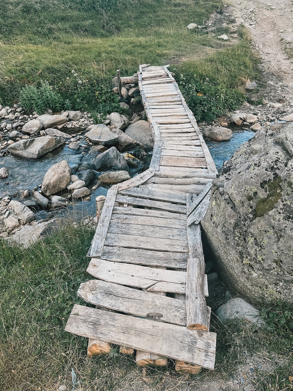
When I think I’ve found the start of the trail, I try to jump a small stream but completely misjudge the distance and my weight with my backpack, and I land in the stream with both feet. Great, just great. Wet feet for the rest of the afternoon.
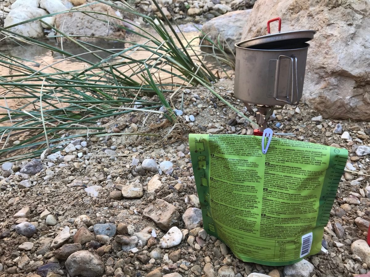
When I open my food bag to catch my breath, have a snack, and regroup, I notice that my Powergel sachets have ruptured and are dripping all over my other food. Perfect.
Finally, I start the steep ascent from Valbone towards the Prosllopit pass, but I lack any cadence or speed. Step by step, I try to get into the rhythm of the trail. I keep checking my watch for speed and am frustrated by everything. I could easily blame it on the 2 hours of sleep last night, but that’s just too easy.
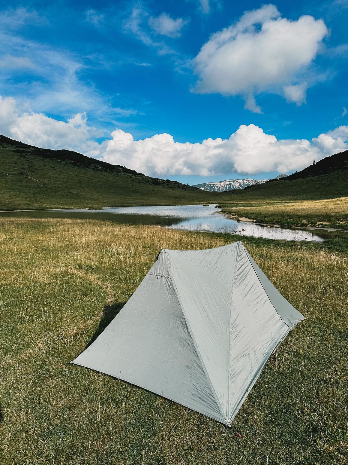
After a few hours, I spot the perfect flat surface to camp for the night. Out of the wind, flat, with beautiful views. Only when I arrive, it becomes clear that it was also the perfect toilet for the livestock grazing nearby, as the ground is littered with cow poo. Sure. Why not?
When I find a new spot and can pitch my tent, I notice that my air mattress – which I had checked before leaving – has a hole in it and fails to inflate. Amazing.
Finally, for whatever reason, my Garmin InReach reset to previous settings, and I can’t get it to work. As a precaution, I check-in every morning when I break camp and check-out when I pitch my tent via satellite telephone with my family, just to let them know I’m safe and where I am (the phone automatically sends my exact GPS coordinates). Without cellphone reception, I can’t check-out via WhatsApp, and I can’t reset my InReach. Fantastic.
What. A. Day.
I can only conclude that slightly over 19 months off the trail made me rusty; it must be trail-rust.
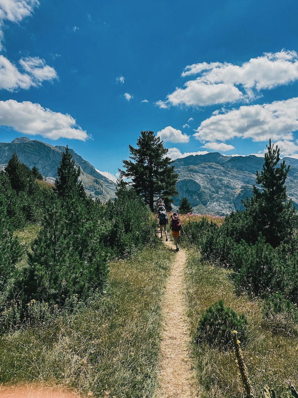
Day 1: A day of firsts
Stage 1: Prosllopit pass to Doberdol (29.6 km, 1400 elevation gain, 7,5 hours)
New day, new chances. After a good night’s sleep, I pack my tent and gear and set off for Doberdol. It’s my first true day on the trail, and I’m looking forward to soaking it all up. I missed this so much.
And I’m not disappointed. The trail looks great, and the views are amazing. It is a day of many firsts. I run into my first of multiple sheep traffic jams on the trail, making me wait until the sheep, the shepherds, and especially the dogs have passed (make sure never to come between the sheep and the dogs, as that usually does not end well). I bump into the first local makeshift cafe that sells cold Coca Cola (I hardly ever drink cola, but on hot days on the trail, it’s just divine). I jinx myself for the first time this trip by mumbling aloud that it’s all going so smoothly, just moments before I slip, fall, and in the process, break my USB charger plug. And somewhere on the descent to Cerem, I bump into my first group on the trail, about 20 immaculately dressed Italians moving their way up to Maja Kolata pass.
When I’ve passed most of them, their guide asks me how the weather is on the Maja Kolata. He clearly does not know. I don’t either, as I did not make the extra loop to the Maja Kolata. But I do know it’s windy that day, that parts of the trail towards Maja Kolata are exposed (rocky, open in the wind, with a big drop), that every year several lives are claimed by the particular route and that most of his group are dressed more for yoga or cycling class than for a tricky hike up a dangerous peak. I stress my concerns, and we both go our separate ways. It is the first (but not the last) time I get confronted with what I’ve experienced on the Arctic Circle Trail in Greenland and on the Jordan Trail; hikes look perfect on Instagram until they don’t in real life.
When arriving in Cerem, I decide to try the local cuisine for the first time at the trail-famous Kujtim Goçi Guesthouse. It is just perfect. It is the simplicity yet perfectness of the potato/carrot soup, the tomato/cucumber/onion salad, local bread, and some rice with vegetables and meat. The hosts are extremely friendly and welcoming, and it is a more than welcome re-fueling for the rest of the day.
Another first is later that afternoon. I follow a 4WD (Four-wheel drive road, one of many) up the hill and at some point routinely check my GPS to see if I’m still on the right track. And it turns out I’m 1 kilometer off and missed a trail up the mountain. I was 100% certain that I follow the 4WD track straight on as described in the trail booklet. After returning to the specific point, I see what happened. There is a turn in the road, where there indeed is a secondary path straight on, but over the years, the turn has become the main route, letting me follow the main route through the turn, rather than follow the secondary road. It is the first of many times that signage is not 100% clear and what is written in the description in the booklet is overtaken by reality.
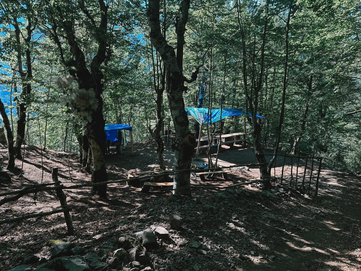
When I arrive in Doberdol around 19h00 that evening, I was tired and did not have the energy to walk on, climb out of the valley, and find another place to stay. So I decided to camp at Guest House Bashkimi to find another first. A group of more than 40 other Dutchies is also camping here, on their condensed version of the trail (5 days, only parts of the trail). And a final first of the trail; one of the group needs to be evacuated because of illness.
Enough first for the day, and I go to sleep early.
At least, that is the plan. And the trail is what happens while you’re busy making other plans. During the night, it starts to rain and the wind picks up. The sign for one of my trekking poles supporting my tent to five up on me and collapse. I finish the night with a poorly pitched tent and only one trekking pole. Perfect way to finish the day of first.
Day 2: Settling into the trail
Stage 2: Doberdol to Lake Pusi i Magareve, just beyond Milishevc (23.6 km, 1400 elevation gain, 6,5 hours)
I’m happy that the second day brings fewer firsts and unwanted surprises. I settle into the trail, enjoy the environment.
Main insight of the day is the water situation. I had been warned about the water in Doberdol (the river there is polluted by toilets in the higher areas dumping their literal sh*t into the river so by all means, to be avoided), but even despite me being very cautious, I can’t leave Doberdol without some stomach issues – same for the larger part of the Dutch group. Additionally, it is difficult to predict the water situation. In general, there are way more water points, springs, streams etc on the trail than described in the booklets. However, they are usually not in the place where you would expect. Spring and streams that should there based on the information in my booklet or GPS are not there, while in other places you’ll pas 3 streams with perfect water in the span of several minutes. In other words; water is hardly a problem, it is fine to go with the literal flow but plan for your water points not to be in the places where you expect.
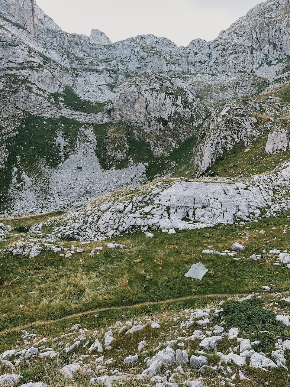
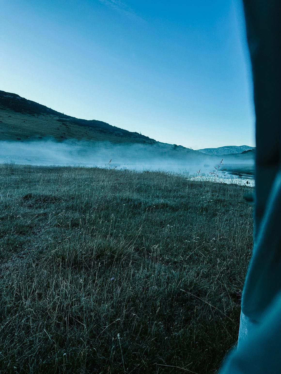
I keep a good pace, have a good lunch in Milishevc, and hike up to Lake Pusi I Magareve to camp there. I’m the only one there and go to bed early to make up for the bad sleep I had last night because of my collapsing trekking pole.
Day 3: Cold awakening
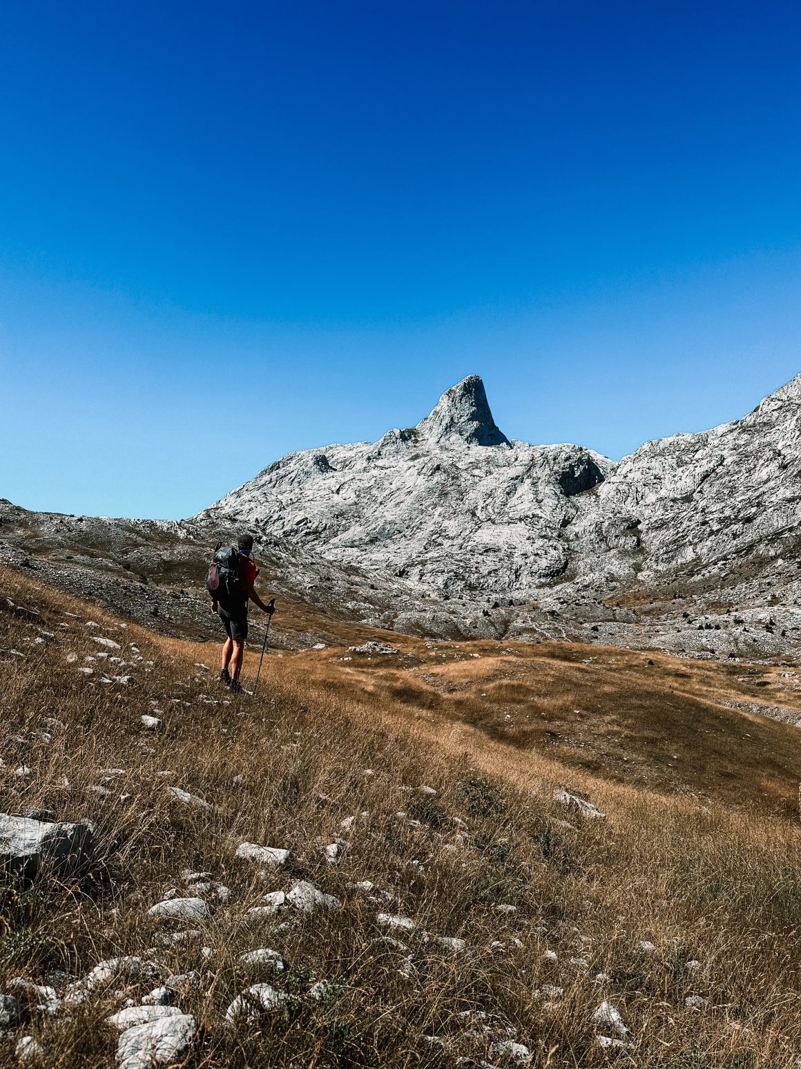
Stage 3: Lake Pusi i Magareve to Drelej (23.1 km, 1000 elevation gain, 6 hours)
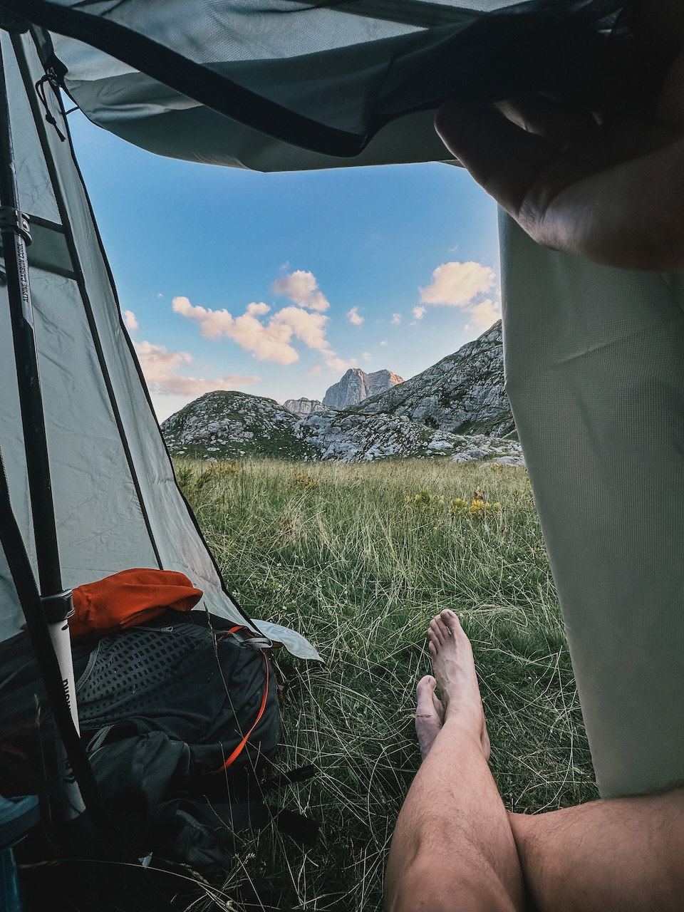
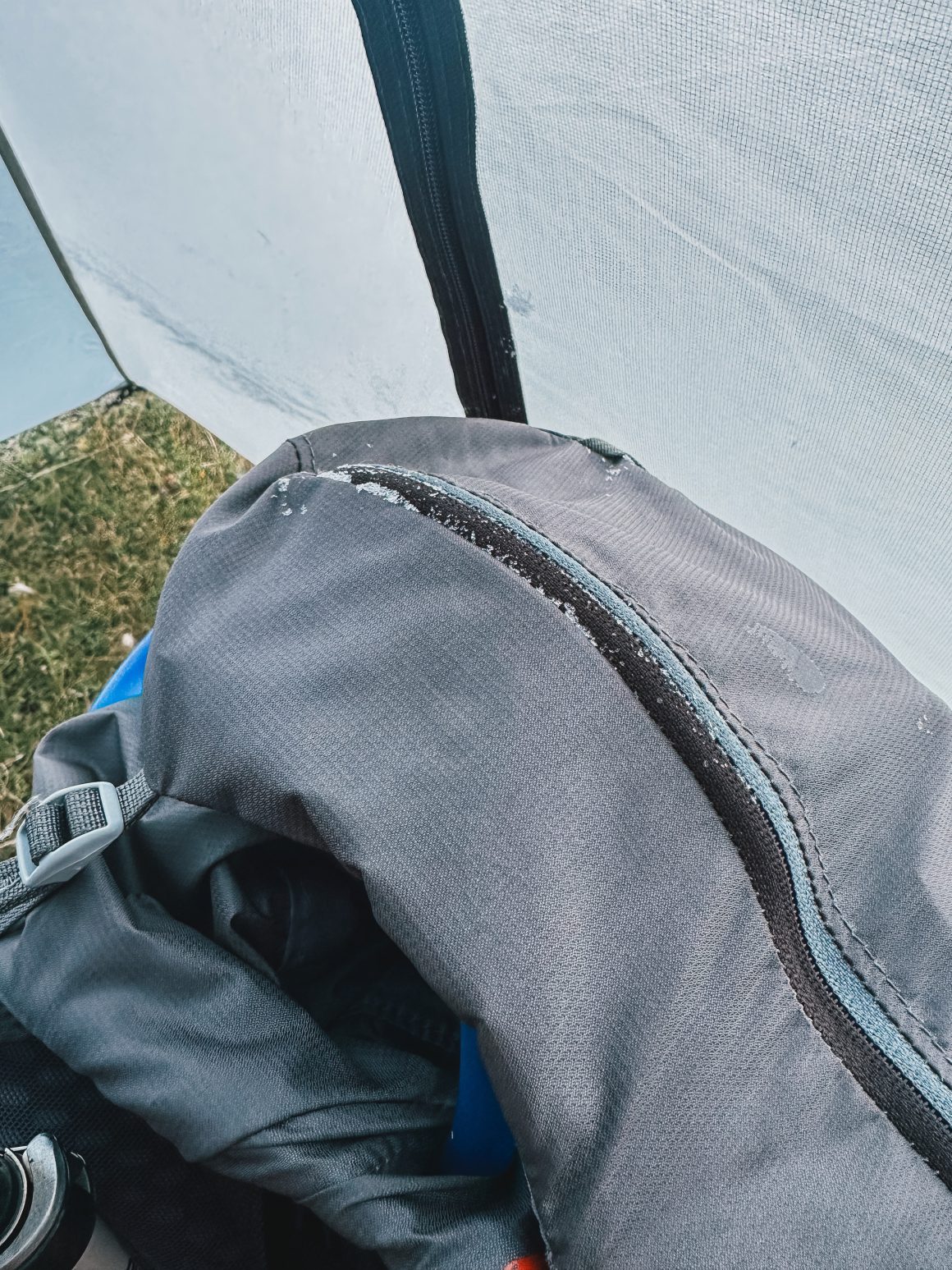
I wake up after a rough night. The temperature in the valley where the lake is located had dropped below zero, and the cold had kept me awake throughout the night. Eventually, I slept in my sleeping bag with all my clothes on: two t-shirts, my fleece jacket, my rain jacket, and my long trousers just to keep warm. My backpack, which was inside my tent, has ice on it. The outside of my tent is completely covered in ice, and my hands end up numb while trying to fold the tent again. I pack as quickly as possible and move out of the valley and into the sunlight to warm up. It takes me 15-20 minutes to have full feeling back in my hands and feel comfortable again.
After warming up, I’m curious to see how my knees will hold up during the long descent from Pusi i Magareve to Rugova Camp. Over 1000 meters of descent over a length of 7 kilometers is just asking for trouble, especially after such a long period of inactivity. Remarkably, my knees and legs hold up very well, and I’m able to keep a decent pace going down, making it a very smooth start to the day.
I have one important decision to make. The route from Drelej to the next village, the Restaurant Te Liqui in Kosovo, follows a busy road for 13 kilometers. So it’s either pushing for Restaurant Te Liqui or staying in Drelej. After covering over 7 kilometers on the asphalt road between Rugova Camp and Reke e Allages, I decide I’ve had enough of the asphalt and ask the owner of the Shquiponja Guesthouse if he can bring me to Restaurant Te Liqui to skip another long stretch of road and also make the next day bearable.
I use the remainder of my day at the very welcoming and comfortable Shquiponja Guesthouse to relax, get some rest, have a good meal, and prepare for the busy day ahead.
Day 4: The marathon day
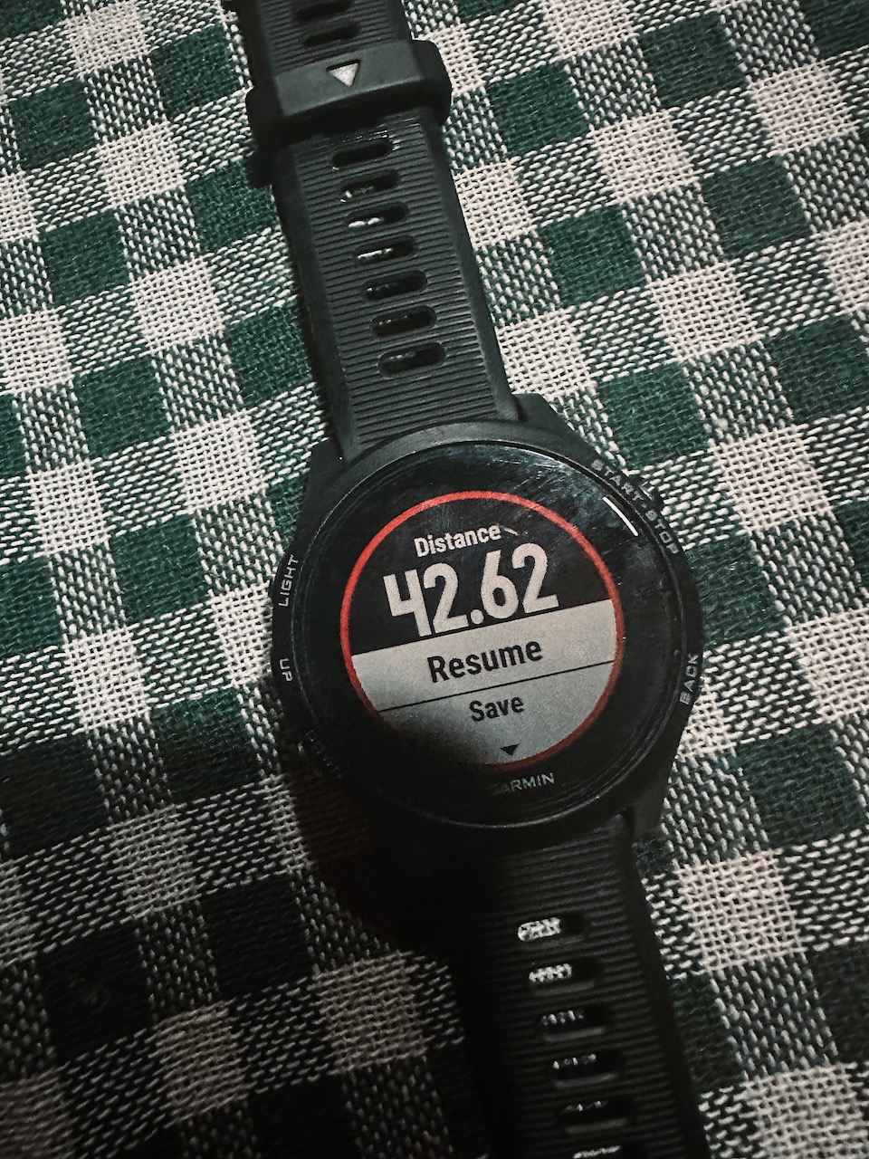
Stage 4: Restaurant Te Liqui to Plav and beyond (42.6 km, 1900 elevation gain, 10 hours)
Despite skipping the Drelej to Restaurant Te Liqui part, today promises to be a very long and challenging day. The friendly owner of Shquiponja Guesthouse, Ilir, drops me at Restaurant Te Liqueni around 8h30 and I start the long road to Plav, a total of 35-36 kilometers.
It should be doable, as the main challenge was in the first 7 kilometers of the trail, climbing slightly over 800 meters towards Qafa e Jelenkut. After that, the trail was mainly flat or descending.
I had struggled with the steep ascents in the previous days and made some adjustments. I changed my Garmin watch to show my heart rate rather than speed, distance, and hours passed. I had noticed the latter distract and disappoint me and would entice me to make more short stops than I wanted/needed. Additionally, I adjusted my pace. Rather than my normal pace, I would take smaller, slower steps but not stop (the pole-pole approach I learned on my way to the Kilimanjaro summit).
I stopped for lunch at the Eco Lodge in Bobino polje. Although still heavily under construction, it was very welcoming. I played a game of Uno (which apparently is insanely popular in the region) with the son of the owners and had a great lunch. When I checked my phone for messages, I saw a friendly message from the owners of the guesthouse where I was staying that night in Plav. At least, that was what I thought. I remembered checking the guesthouse to be close to the trail. I booked Guesthouse Grandfather’s Place, which is indeed close to the trail. But later, when prepping for the trail, I confused it with another guesthouse, Grandpa’s House, which is also in Plav and next to the trail. But while Grandpa’s House is in Plav itself, Grandfather’s Place is in Budovice, another 6-7 kilometers from Plav. It means I don’t have another 20 but another 27 kilometers to go that day. Pretty much a full day of hiking. So, I quickly pack my stuff, refill water, and step up the pace to make it to Budovice in time.
Luckily, it is a long but straightforward route with lots of 4WD tracks, which help me keep up the pace and actually reach speeds up to 7kms per hour on foot, which is close to the pre-COVID me.
I only allow myself to have a short break at the stunning Hridsko Jezero lake. It is a great place for a swim (unfortunately no time) or camping (definitely no time for that). I enjoy the amazing view and sit down next to a large group of Croats enjoying some time in the sun. After 15 minutes, I break camp and speed back to Plav and Budovice.
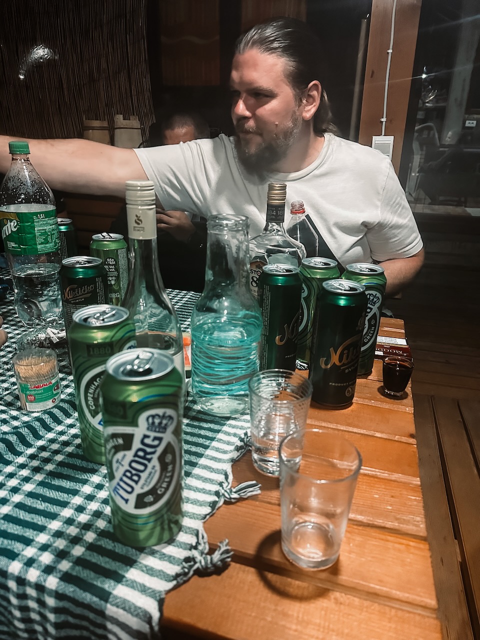
When I finally arrive at the guesthouse, it is already dark. To our surprise, the same Croats that were at the lake that afternoon are now having dinner and some drinks as a pre-celebration of one of their birthdays that evening. They invite me over for one shot of local rakije and before we know it, it is 03h00 in the morning.
Day 5: Recovering on an unforgiving trail
Stage 5: Beyond Plav to Vusanje (16.8 km, 1000 elevation gain, 4,5 hours)
After the long day and even longer night, I allow myself to sleep in a bit. The guesthouse, Grandfather’s Place, is the perfect spot to do so. It is by far the best accommodation I have had on the trail. The Feratović family is extremely friendly and welcoming, doing everything to accommodate their guests. The sons are amazing hosts, the mother is responsible for the great home-made food, and the father ensures that the property is well-kept. After enjoying a delicious breakfast and even being allowed to wash my clothes, I leave my new friends around 11h00 to break for Vusanje.
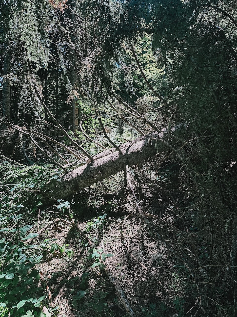
The Feratović family shows me a path directly from their guesthouse back to the trail (to a katun on the trail that bears their name), which turns out to be less traveled than the Peaks of the Balkans trail. It takes some climbing of fallen trees and detours to finally reach the saddle just before Bajrak peak.
This point is notorious since it is just before the steepest climb of the trail. I take a quick break before the climb. It turns out to be a popular moment and popular track that day. I encounter two Belgian ladies and three Germans, and I hear that I just missed another group of 40 Dutchies. One of the ladies from the group lies flat on the trail with a guide and her husband due to calf and stomach cramps. I feel really sorry for her; it is her first day on the trail. I offer to help, but the guide is already in control, and she will be evacuated soonest. This is another proof that although the trail might seem convenient and Instagram-famous, it is still nature, and the trail is often unforgiving.
I proceed on the trail and one by one catch up to the group of 40. It is a nice insight into the kinds of people joining these groups. From people trying to lose weight and seeing this as a valid option to do so, to a local guide who is sometimes clearly annoyed by the group’s ignorance about local culture and history, from older couples to groups of guy friends, from dad-son couples to amateur hikers.
Later, I stop at one of the makeshift cafes on the trail to recover and get into conversations with two Australians who are scouting the trail to offer tours for Australians and with one of the guides of the Dutch group who offers me to join them next year as a guide. I politely decline; it feels like there are already too many guides and groups on the trail.
I proceed comfortably and finish the last stretch towards Vusanje, where I have dinner and an early night of sleep to recover from last day’s marathon.
Day 6: Change of plans to avoid bad weather
Stage 6: Vusanje, via Theth to Valbone (37.9 km, 2000 elevation gain, 10,5 hours)
I was disappointed with the dinner at the guesthouse, so I decided to skip breakfast and rely on my own stock of bars and other foods. I hit the trail early to give myself some flexibility on the day. I had heard that the weather would turn bad tomorrow, so having some extra time gave me some flexibility just in case.
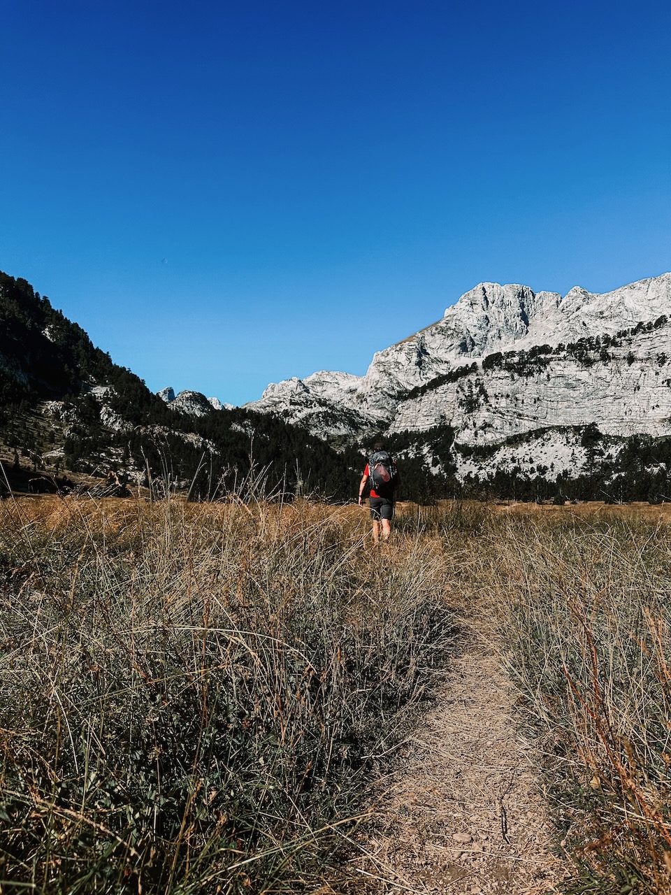
The route through Prokletije National Park towards Theth was beautiful. I made a quick stop at the Blue Eye of Vusanje, a deep pond with a stunning river streaming from it. I enjoyed the view of the stunning Maja e Harapit before descending towards Theth.
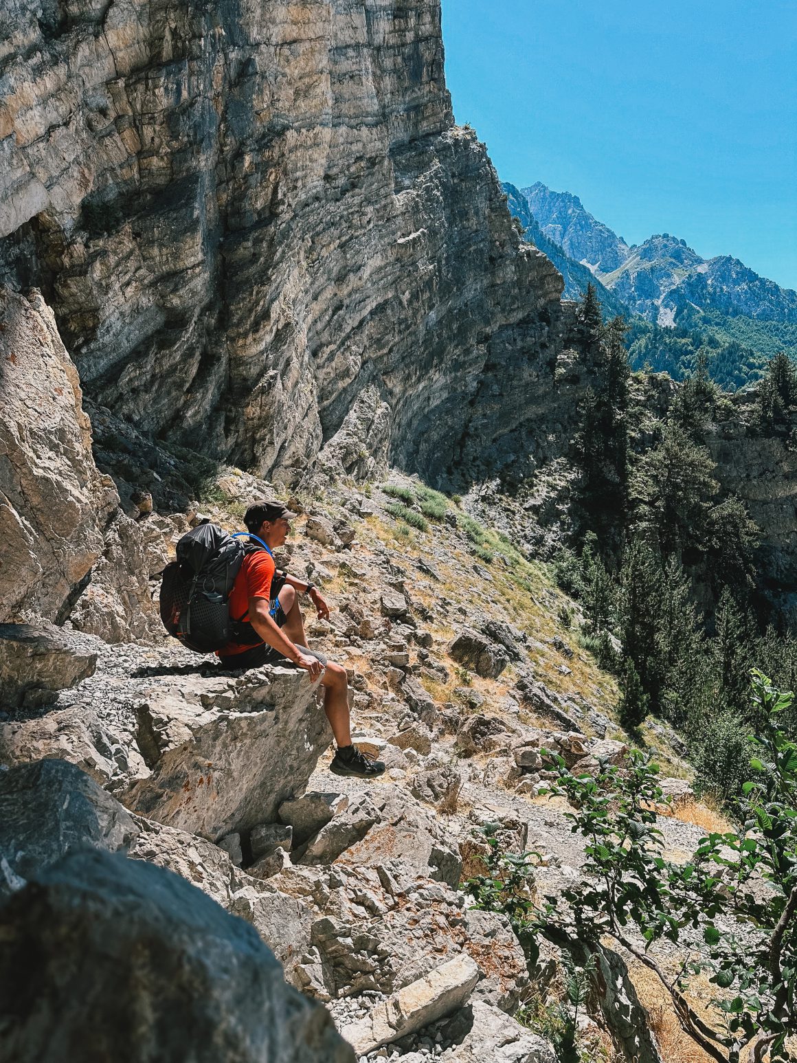
I got a new sense of how popular the trail is while doing the steep, tricky, and technical descent towards Theth. I encountered several Dutch couples, an Italian family that had run out of water, and several other smaller groups. Water was scarce going up, so I gave the Italian family everything I had, knowing I would be in Theth soon and could restock. Theth was a vibrant village full of tourists making day treks, going swimming, visiting the famous church, and exploring the rest of the old village.
While having lunch in Theth, I checked the weather again and saw that the predictions of bad weather for tomorrow seemed to be coming true. I had planned to camp beyond the Valbone pass and walk the last 10km on my last morning to catch the 10h30 bus back to Tirana. But that seemed too uncertain, so I decided to push as far as I could get to Valbone, ideally one of the earliest guesthouses in Valbone. However, due to an overwhelmed restaurant that took ages to serve lunch, by the time I finished, it was already 15h15. That meant I had five hours for 19.5 kilometers, which normally takes eight hours. It also meant no Theth waterfall or Theth Blue Eye.
I fully restocked on water for the hot and steep ascent to the Valbona pass. It was an interesting ascent as every few hundred meters, I encountered a new group of hikers descending back to Theth after enjoying the view from the Valbone pass – exactly the opposite of my intentions.
I met an interesting group of characters along the way. Probably best illustrated by what a lady taking care of one of the cafes on the mountain tells me. Multiple times per day, she says, tourists climbing towards the Valbone pass would ask her if they could pay with a card at her cafe. It drives her nuts, frustrates her immensely because her cafe is literally in the middle of nowhere, and cash is the only way to pay (as in the whole area). Some groups confuse me with a guide (eventually, I heard, because people thought I was fast and carried both my Garmin InReach and GPS on my chest) and would ask me for how long it will take them to reach Theth (which is impossible to assess – it is hard to guess speed and distance for a group of people you don’t know). I am pretty sure, however, that some of them did not make it before dark. I am determined to avoid the same fate and step up the pace.
Around 18h00, I reached the Valbone pass and pushed on to make it to Valbone in time. I increased my pace even further and finally arrived at Valbone at 20h20. What a day. What a week.
The next morning, I am very happy I did push so hard the day before. The weather turned completely. Lots of wind, massive rain showers would have made it impossible for me to get to Valbone in time and would probably have spoiled a good night’s rest.
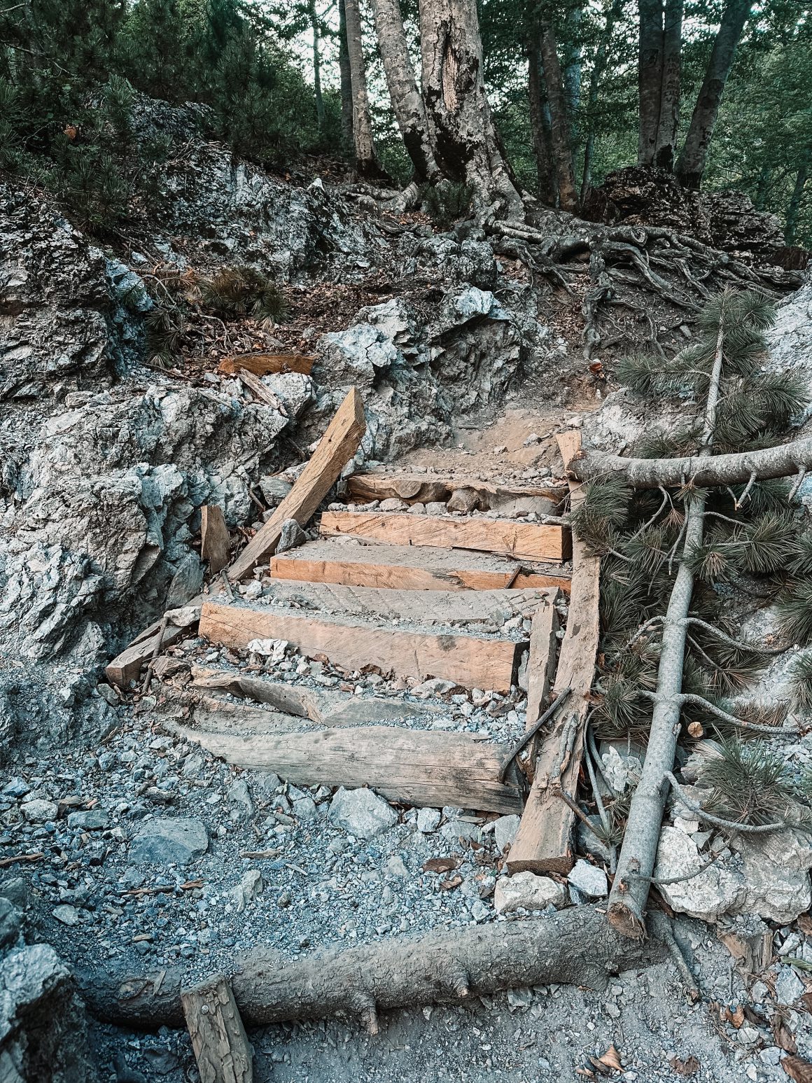
A final reflection. The stairs-ficiation of the Peaks of the Balkans
Wooden stairs. Wooden, uh, stairs. It is the last day, and they summarize what has probably been bugging me with the Peaks of the Balkans trail. It is getting too popular, too busy, and too commercialized for my personal liking.
Don’t get me wrong; the Peaks of the Balkans is a fantastic trail. The views are amazing, the trail (apart from some longer asphalt stretches) is fun, different, and beautiful. The people are amazing; throughout all the years on the trail, I have not seen so many friendly, proud, genuinely interested locals. I enjoyed each and every day on the trail, and I would definitely recommend that you try it before it gets spoiled.
On the best days, it gives me the unspoiled vibe of Greenland, the Faroe Islands, Iceland, or the Jordan Desert. On the worst days, it is more like the Four Day Marches in Nijmegen, trekking the Kilimanjaro, or the Camino Santiago. Over the years, I have started to prefer the former.
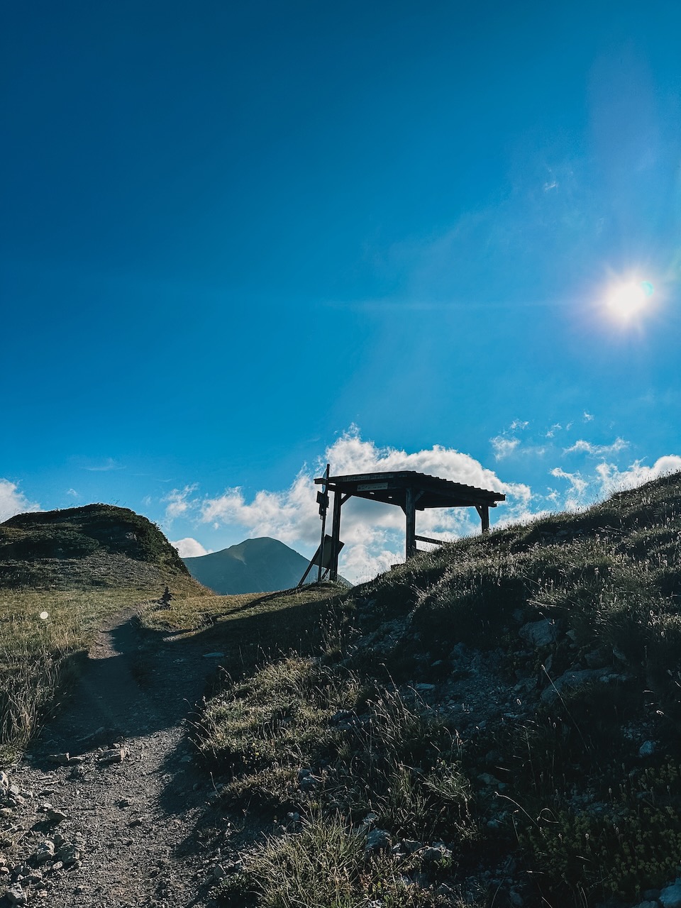
The “makeshift cafe” from the booklet in 2016 is now a brick-and-mortar cafe with a kitchen. The “scattered summer camps” from the same book are now full villages. One of the cafes on the trail charged €3 for a can of Coca Cola in a bucket of water (prices varied between €1.50 and €2.50). There is a horse/donkey service to carry your luggage. One of the guesthouse owners along the trail changed the markings to lead the trail around his house. And there are stairs. No trail needs stairs. Period.
And with accessibility, awareness, and commercialization come also the dangers. Over only my six days on the trail, I have seen one person being transported off the mountain because of cramps, one of illness (and plenty of others suffering from lighter forms of illness around Doberdol), a large family that didn’t plan well and was about to get stuck on the mountain in the dark and had to be transported out by a cafe-owner on the mountain, and several hikers who were not up to the task of hiking one or multiple stretches of the trail.
After my Kilimanjaro experiences, I wrote, “All is fun and games until it isn’t“. In a way, I fear for the Peaks of the Balkans. I hope we can keep it fun and safe together.
Updated note: on the same day I’m posting this, Dutch NOS news site published an article on more and more hikers getting into trouble because of inexperience, bad planning, climate change and just bad luck.
What I learned from a week on the Peaks of the Balkans trail
So, after 6 full hiking days and some extra time in the region, what are my key learnings?
- Amazing trail, even nicer people. The trail is stunning, and the locals are even more impressive. They are extremely friendly, welcoming, and genuinely interested in visitors.
- Be well-prepared. Although the trail is overall well-marked (more on that later) and should be doable for many people, it covers many climbs and descents. It is still nature, and the weather can change rapidly (as I learned in the Nordics). I should have triple-checked my gear (my trekking pole and air mattress failed on me). Overall, better training, more planning of the days and routes, and proper gear are essential.
- Popular trail. The trail is gaining popularity fast. I encountered two groups of 40 Dutch hikers, and I cannot even count how many others I met on my last day on the trail (the routes leading in/out Plav and Theth are notoriously busy). These crowded trails are not for everyone. In the future, I will probably opt for less popular trails or choose “shoulder-season” moments in the year.
- Be aware of trail changes. The region is evolving so rapidly (e.g., deforestation, new roads, new buildings, guesthouse owners changing markings, trail not matching the description in your book or GPS file) that you should continuously be on the lookout for changes.
- Have a GPS. Although the trail is well-marked, several instances every day require the checking of a GPS for changes. It is essential to have a good offline hiking map on your phone or a dedicated GPS device like a Garmin GPSMAP.
I updated my planning and packing list accordingly.
Feel free to let me know what you think in the comments or reach out to me if you have any questions!